Our Services
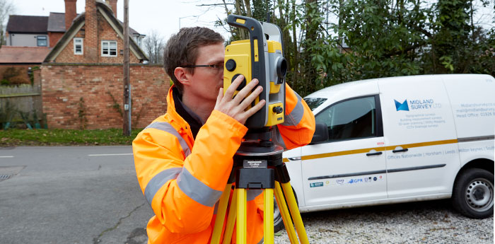
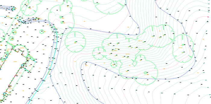
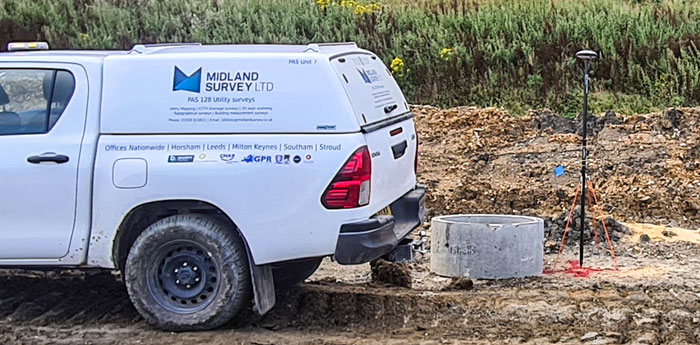
A topographical survey encompasses both manmade and natural features, as well as the contours of the land. Our topographical surveyors use a combination of traditional techniques and specialist equipment like Total Stations alongside dedicated terrain mapping software. This helps us pull together complex volumes of data and build a complete picture of your site. Our drawings are exceptionally precise and well presented, using dedicated terrain mapping and CAD software. We can accommodate plans provided to us as a jumping-off point, tailoring our work to the individual needs of the client. All our drawings are verified by a Senior surveyor and provided to the relevant party in CAD format and as PDFs, with paper copies available upon request.

While traditionally, most topographical surveys have been produced in 2D format, today we understand that 3D topographical surveys can provide much greater real-world insight, helping improve overall design accuracy.
Our detailed and highly accurate surveys can be produced in 2D and/or 3D format. They give architects, engineers, planners and developers an unparalleled level of detail relating to their site, the built environment and surrounding infrastructure.
When it comes to resolving boundary issues, obtaining a definitive map of existing features is absolutely key.
Working within stringent regulations, our specialist surveying expertise and knowledge of English and Scottish law can help bring clarity and confidence to boundary disputes in all kinds of environments. Our boundary surveying experts promote trust and communication between disputing parties and deliver drawings that clearly set out the facts. With a growing workload in this field, we deliver reports compatible with Civil Procedure Rules part 35 (CPR35). Our reports detail the documentation that we have reviewed, our method of work and the conclusions that we have made from the information available.
Setting out establishes controlling dimensions and references from the architect’s plans on the land. It determines the position, extent, angle and level of new buildings and their foundations, as well as their distance from other structures, roads and rights of way.
Based on physical markers positioned by your setting out engineer, the construction team will start their building work. Using the latest equipment including Total Stations and specialist terrain mapping software, our expert team of surveyors will help you ensure your project is perfectly executed from a legal perspective. This eliminates the chance of boundary disputes later and enables your construction team to follow the architect or engineer’s plans with absolute precision.
Understanding the contours of your site is essential in the planning of any construction project.
Gathering elevation data helps you build a complete picture of your site, revealing the most efficient paths for roads and tracks, and indicates how much soil and other materials you might need to ensure your construction plan and engineering design fits the surrounding terrain. Our expert team of surveyors use cutting edge technology and specialist software to quickly map the contours of your site, providing you with a highly accurate plan of your elevation data to help inform your next steps.
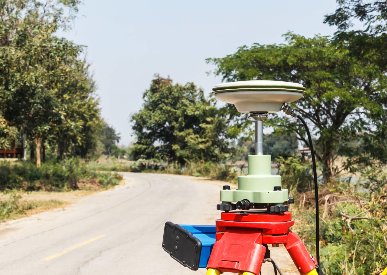
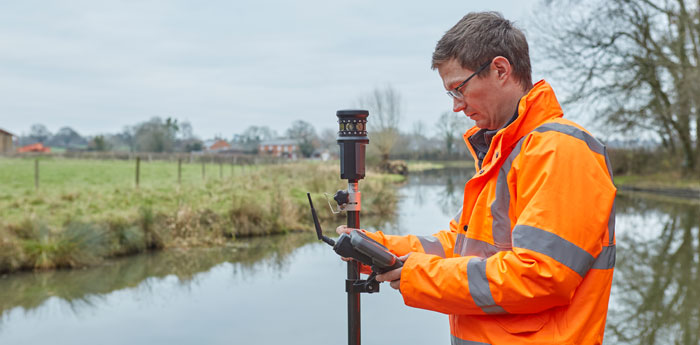
The adoption of GPS technology means that land surveyors are now able to make complex calculations with greater efficiency and exactitude than ever before.
A landmark moment in the evolution of conventional surveying techniques was to use satellites to accurately pinpoint the location, distance and dimensions of any given site at the touch of a button. All we need is a clear view of the sky and our sophisticated instruments can obtain location, distance, and height measurements almost instantaneously. GPS information can be added to many of our land surveying services, allowing us to create your drawings with unprecedented speed and accuracy.

When we are talking about buildings and the land they sit on, even the smallest movements can spell big trouble.
Where movement and instability is suspected, a monitoring survey is the best way to precisely track shifts and changes over time to gain a better understanding of the problem. Our instrumentation choice can be tailored according to the accuracy required. Once monitoring points have been agreed and positioned, our surveyor will visit your site at regular intervals, taking readings at fixed monitoring points, comparing their findings to previous results and detecting if any movement has occurred. These can be reported through a simple excel spreadsheet.
Cross-section surveys help you understand the difference between site designs and the actual terrain at any given time, so you can feel confident that your site is conforming to design plans and regulations.
Our skilled team of cross-section surveyors use Total station and GPS equipment to accurately map cross sections of your site and present the data in a simple drawing format.

When embarking on any new project, it is more important than ever that we move forward responsibly, giving proper consideration to the impact on the local environment.
We offer a variety of ecological surveys, designed to accurately identify the species that call your site home. Integration with our Topographical surveys is simple and straightforward if required. After our ecology consultants have made their appraisal, you will be provided with an easy-to-understand report that can help inform the rest of the project process.