Boundary Surveys

Boundary surveys determine the exact location of the property lines of a parcel of land. Our land surveyors use specialist equipment and techniques for accurate results.

Boundary Surveys

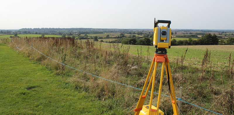
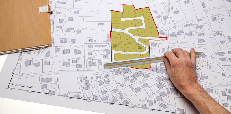
What is a boundary survey?

A boundary survey is a detailed examination and measurement of a property’s boundaries. It determines the exact location of property lines, corners, easements, encroachments, or other relevant features.

Boundary Surveys

When do I need a boundary survey?

Boundary surveys are perfect for property owners, real estate professionals and developers. Reasons why you may need a boundary survey include:

  • Buying or selling a property
  • Building a new structure on your property
  • Renovating your home
  • Resolving boundary disputes with neighbours
  • Getting a building permit
  • Dividing a property into multiple parcels
  • Establishing an easement
  • Surveying land for agricultural or commercial purposes
  • Land Registry Applications

Benefits

Boundary Surveys

Clearly establishing the property lines can save time, money and stress caused by boundary disputes with neighbours.

Boundary Surveys

Make sure neighbours aren’t encroaching on your property, and vice versa. This is important if you’re building a new structure or making changes that could affect property lines.

Boundary Surveys

The information from a boundary survey helps with planning future development, managing your property and resolving insurance claims. The accurate data about the size and shape of the property can help with valuations.

Boundary Surveys

Boundary surveys can identify wetland and flood zones. Learning about these issues before purchasing or changing a property is important.

orange graphic

The Process

The boundary surveyor will visit the property and conduct an inspection where they evaluate current boundaries that limit land. They will look at the property documentation which may include historical maps and photographs to spot any previous boundaries. 

To then identify the land’s boundaries, surveyors use total stations and GPS kits.

Next, photographs and videos are taken of the property to compare its condition against the information in the historic documents. If a legal boundary survey is being conducted, these may be used as evidence in court.

Midland Survey can overlay supplied title deeds or purchase Ordnance Survey data and combine this with the information taken from the site. This is useful for highlighting any discrepancies between the documented and physical boundaries. If new boundaries are being applied we can provide Land Registry compliant drawings to assist the application.

As a further service, we can return to the site and mark proposed boundaries using timber pegs in accordance with the updated Land Registry documents.

Contact us today to see how we can help with your boundary survey project. Call us on 01926 810 811, or fill out our online contact form.

Applications

Boundary surveys have broad applications in land management, real estate, construction, and various other industries. Common applications include:


Boundary Surveys

Planning and developing land for residential, commercial or industrial purposes. Boundary surveys ensure that construction sticks to the regulations.

Boundary Surveys

In housing developments, boundary surveys are useful when subdividing large areas of land into smaller lots.

Boundary Surveys

Builders use boundary surveys to place structures, roads, driveways, and utilities within the property boundaries. This prevents neighbourly disputes.

Boundary Surveys

People looking to purchase land often commission boundary surveys to understand the property’s exact boundaries and any potential limitations.

orange graphic
Boundary Surveys

Why Midland Survey?

Our expert team has over 30 years of experience completing accurate boundary surveys. We use the latest technology to produce reliable results and get the report to you quickly so your plans stay on track.

Midland Survey has offices in Southam, Stroud, Leeds, Horsham and Milton Keynes and we provide our services anywhere in the UK.

Case Studies

Four homeowners in Monks Kirby, Warwickshire purchased and divided a large area of pasture land that backed onto their homes.

Midland Survey surveyed the pasture land and produced a Land Registry plan on how it was going to be divided up between the four properties. Once agreed we returned to the site and set out the boundaries and demarcated the position using timber pegs at 20 metre intervals where appropriate. 

These were used to guide the fencing contractors or the hedge layers on the correct agreed position. The four owners made an application to Land Registry using our drawings to illustrate the new legal boundaries for the extended properties.

Contact us today to see how we can help with your monitoring survey project. Call us on 01926 810 811, or fill out our online contact form.

FAQs

You can expect to pay between £550 and £700 for a standard boundary survey, which includes the production of the documentation.

The cost of a boundary survey will depend on the size and topography of the land, the level of detail, the timeframe for getting the survey results and the location.

A physical boundary survey can take hours to complete. In comparison, establishing a new legal boundary survey can take days since several site visits may be needed.

A boundary survey determines the location of property lines only, whereas a topographic survey maps the elevation and physical features of a piece of land within.

A Land Registry title plan is a map that shows the general boundaries of a registered property; however, it isn’t a survey. A boundary survey is required to find out the exact location of the property lines and this can be compared with the Land Registry document.

Although you can find property lines on Google Earth, these aren’t reliable and verified and cannot be used as legal documents.  For accurate boundary lines identified by an expert, opt for a boundary survey.