We are delighted to be able to announce today the next step in our journey, our successful acquisition by Lucion Services, part of the Lucion Group.  

The Management Team will continue to run Midland Survey Ltd, with the support of the Lucion Services Managing Director, Jeremy Meredith. 

Lucion Services are market leaders in providing accredited and certified scientific hazardous materials testing, inspection and environmental management solutions, operating with teams and offices across the UK including state-of-the-art laboratories and head offices in Gateshead. 

Lucion has acquired 100% of the shares in Midland Survey Ltd. We will continue to trade as Midland Survey Ltd, forming a specialist topographical surveying division of the wider testing, inspection and consultancy services Lucion offers to national and international clients.

There will be no major changes to our day-to-day operations and David Johnson will remain as MSL’s Managing Director and continue to lead the specialist topographical surveying division and contribute to the future development of Midland Survey within the Lucion Group.  

The deal provides an opportunity to offer our collective clients a wider service offering, as David Johnson, Managing Director at Midland Survey explains; “We are looking forward to a bright future as part of the Lucion Group, one that will be beneficial to all our clients”. 

Joining Lucion Services, our comprehensive topographical surveying service combines with hazardous material surveying, infrastructure, marine and offshore inspection and testing services and radiation protection services to offer a comprehensive site assessment service, led by Managing Director, Jeremy Meredith. 

Of the acquisition, Jeremy Meredith stated; “With the acquisition of Midland Survey, Lucion Services now offers a truly national environmental survey capability.  The acquisition complements that of Gateshead-based Landform Surveys, 8 months ago, giving us coverage across the whole of the UK whilst adding more diverse services including non-invasive CCTV condition surveys.” Jeremy Meredith, Managing Director: Lucion Services.

About Lucion Services: 

Lucion Services is the UK’s market-leader provider of industry-accredited and certified experts in hazardous materials testing, inspection and management. They provide trusted environmental risk management services, supporting clients in achieving compliance with occupational health, safety, sustainability and environmental regulations in the UK and internationally. 

As the market leaders in accredited and certified scientific hazardous materials testing, inspection and environmental management solutions, they deliver trusted services to corporate clients who require regulatory compliance to their buildings and/or assets. 

Lucion is part of the Lucion Group, a purpose-driven organisation dedicated to protecting people and the planet. Consisting of several environmental services companies, we provide a comprehensive suite of value-added environmental, health and safety risk management and consultancy services.

Collectively the Lucion Group offer a national and international service with regional presence with a team of 500 technical specialists with skillsets in 50+ environmental consultancy services, including hazardous materials, ecology, air and water services, geo-environmental and sustainability among others.

Your project’s as-built survey is one of the most instrumental reports to a successful build. Making sure you hand over the exact dimensions of the space allows you to have clarity of the entire project.

Understanding what an as built survey is will also help inform you of what an as built survey actually looks like.

surveyor with surveying kit measuring the landscape

What is an as built survey?

An as built survey takes precise measurements inside and outside of your structures and creates a ‘blueprint’ or ‘map’ of the whole project site.

In addition, cross departmental information on works carried out feeds into this picture of the site as whole. 

For example, the electrical department will be using the as built survey throughout the project to grasp any clash detection that may occur.

Being able to see the (for example) design drawings layered on top of the steel works drawings gives cross department visibility and allows the entire team on the project to forecast and avoid issues.


project manager on site with client

What does an as-built survey look like?

The survey itself might look quite dense. However, it is cleverly broken down into departmental asset codes. The codes which refer to each item on the survey so you’re able to review each item with ease and with a methodical approach. 

Can BIM be used as an as-built model?

Yes. You can use the project’s BIM (building information modelling) as an as-built model to help showcase information. It’s common practice to extract 2D information from BIM. The 2D information to use this as the core reference for the health and safety file at the end of the project. 

What is the health and safety file? 

Obviously, no project will be complete without handing over the health and safety file which must include the as-built survey. The survey will give the property management, client and stakeholder clarity of any correctional works. They’ll also be able to view adjustments that have been made over the project. 

With stringent health and safety regulations, you can see why the survey is of utmost importance to complying with the UK construction standard. It’s very useful for everyone to understand the shape of the project when it is handed over.  

What are the benefits of an as-built survey?

  • Allows project managers and the project team to have clarity on cross departmental work
  • Allows contractors and project managers to plan and aid early clash detection 
  • Allows stakeholders and project clients to understand the progression of the project
  • Gives a clear footprint of the build when handed over to the client 
  • Helps smooth out any cross departmental issues more efficiently
project manager on site with client

When is an as-built survey carried out?

Your survey will be carried out at various key stages of the project. As contractors add their element of the build in, you’ll need your survey updated. With as-built surveys being taken to record variations on the original engineering plans, you’ll be able to prove and record if the project is aligning with the proposed site plans. 

At Midland Survey we’ll be with your project at every stage of its development. We’ll provide you with a rendering that promotes transparency between all project stakeholders. Get in touch today and let us help you start your project on the right footing. 

Bringing your project to life with 3D modelling can really seal the confidence of all of the project stakeholders – including yourself. 

When your project is in pre construction, it can be difficult to understand your structure’s dimensions on site, the complications of multiple contractors or the marriage of design and engineering. However, with 3D modelling you can see a fully realised and scaled down version of the project before you’ve even laid the foundations.

Learning more about 3D modelling

A digital scale model for visualising the project in full. Our 3D modelling specialists use a variation of technologically advanced 3D lasers, 3D fly throughs and modelling software to measure your site with precision and draw up a digital plan of the finished project. 

The measurements are pulled together to create an accurate digital life drawing of your project. These can be easily animated and used for virtual tours around the building or site. 

In construction, 3D modelling helps stakeholders produce the build more efficiently and with a reduction in expenditure. 

You may have heard of BIM (Building information modelling)? BIM is the progressive partner to 3D modelling. You’ll find it being incorporated as a key feature of BIM during project management. 

3D modelling allows cross department problem solving as well as helping coordinate MEP systems (mechanical, electrical and plumbing systems). 

What are the benefits of 3D modelling?

There are many benefits to having 3D modelling. Here are our top rated ones.

Accurate measurements and dimensions.

Being able to see footfall obstacles in areas early on in the project allows adjustments to be made pre construction saving time and money when nearing the compilation date. 

Lowers the chance of communication mistakes 

It’s sometimes easier to show someone than to tell someone. The 3D modelling allows you to really point out the item you are talking about and even demonstrate solutions with efficacy. 

With projects having so many stakeholders, the chances are there will be a few language barriers to overcome. 3D modelling is a strong visual communicative tool.

Allows stakeholders to have virtual walkthroughs of the building 

Investors, clients, developers alike will all want to know the progress of their investment. Having the 3D model established in the BIM, you’ll be able to take all project stakeholders on virtual tours which will emphasise progress, design and adjustments that need to be made which may affect the timeline of the overall build.

Being able to communicate these implications effectively allows for good communication to be maintained across the span of the project. 

Details and the surrounding area 

Whether you’re getting a 2D or 3D survey carried out, you’ll be able to understand your project in the situation. You’ll be able to see how it relates to the work and landscape around the site. This could even help you with your preservation or enhancement of the site’s biodiversity

You’ll also be able to experience detailed design features like wall colour, tile texture and flooring. This is where your project will really feel like life has been breathed into it. 

How Midland Survey can help you 

Using highly accurate point clouds to create our 3D plans can produce all our models to a high degree of accuracy. 2D plans can be easily extracted from our models giving consistency throughout the project.

With a process designed to make things as easy and straightforward as possible, our services can be tailored to the exact requirements of you and your organisation.
Get in touch today for a free quote and place your trust in experienced hands.

In architecture, engineering and construction (AEC), technology has adapted to propel efficiency, communication and cost. These technologies have been implemented into construction projects nationally. The process for integrating these technologies into construction is called BIM.

What is BIM and how is it used in construction?

BIM stands for ‘building information modelling’. This method of technology is used to manage information in the AEC industry. BIM is not one single technology or process, it is a network of various technologies which help project teams with risk assessment, cost and sharing information as well as much more. 

The implementation of these digital tools means that multiple stakeholders and team members can have visibility on the project at once. Working on the project simultaneously, the BIM model helps reduce budget impacts and increases opportunities in the build environment. 

Red BIM text with red roof graphic over text held with hands by man in red t-shirt

Why is BIM important in construction? 

Construction management is very complex and requires good communication across departments. Design and construction teams are constantly in need of optimising their communicative tools. 

When delays, miscommunication and errors occur, it can have a huge knock on effect to various parts of the project. With the overview enabled by BIM integration, construction and project managers alike can also forecast any issues and iron out unforeseen project hiccups.  

How is it used in the construction industry?

Smaller projects have found the shift to using BIM level 2 guide line significantly more challenging than larger projects. Since 2016, the government has made it mandatory to comply with BIM level 2 guidelines for public sector construction projects

This has now been translated over to The UK BIM Framework in recent years. Nevertheless, from 2016 to now the BIM model allows projects of all sizes to overcome major obstacles, it is being more accepted and embraced by smaller projects.

Digital tools make project management much easier and more streamlined. Furthermore, they avoid any miscommunications across departments which occur when using traditional CAD approaches.

construction of building with blue sky behind BIM text over image

Scan to BIM Software

The BIM process starts with capturing data about a space, ready for the construction process to begin. This data forms the foundations of the entire process, facilitating the creation of a digital model.

Whether the sector you’re in is residential, commercial or the public sector, you’ll be wanting to start the pre planning process with an assured investment of budget on initially surveying. 

Getting accurate data captured will enable communication and progression of the project to get under way in no time. 

We offer a range of quality-assured surveys for commercial properties, including land surveys, commercial building surveys, roof surveys to help you prioritise actions and repairs, underground utilities surveys for commercial buildings and 3D modelling to help guide you through your project.

Get in touch for a quick quote today and speak to our highly experienced team. If you represent a company in the commercial sector, we’d love to hear from you about the scope of your project. Get in touch with us via our contact page, or upload your plan here to get a Quick Quote.

Any site that you’re about to develop on will almost certainly need an ecological survey. The ecology survey is designed to highlight the level of impact projects are going to have on the biodiversity of the site they are situated on.

Developers need to be made aware of any ecological issues or constraints during the pre start phase of the project and will have to put measures in place to minimise impact on the natural environment. 

The ecology survey process will begin long before planning permission is granted. This is simply due to the fact that if evidence of impact is found, a BAP (biodiversity action plan) will be drawn up. The BAP will be added to the proposed planning permission to prove that your project is taking appropriate action to protect the environment and the species living within it. 

Different stages of the ecological survey

The different stages of the survey will take place before, during and after your project to monitor what action needs to be done and if it is in fact being carried out effectively.  

You’ll want to align your project with a trusted and experienced surveyor from the get-go to lower any contingency spends on biodiversity fixes. Midland Survey will guide you through your survey from start to finish with clarity and precision. Get in touch for a quote today.  

Starting with the preliminary ecological appraisal 

The first survey carried out is called the Preliminary Ecological Appraisal (PEA). It can also be known as Phase 1 Habitat Survey. This is a ‘rapid survey, an initial desktop survey as well as a walkover survey. 

The survey is designed to pinpoint any ecological constraints at the start of the project. As well as identifying the negative impact of the project, the survey is used to identify new opportunities for wildlife and habitats on the site. 

A badger moving through long grass.

What species does the ecology survey take into consideration?

Flora and fauna in general but more specifically;

  • Bats
  • Badgers
  • Birds
  • Otters
  • Bees
  • Trees
  • Shrubs
  • Flowers
  • Newts
  • Deer
  • Freshwater fish 

Bearing in mind the results of your survey will prioritise the most endangered species to be protected and restored in your project’s BAP first. You can see the full list of protected and searched for species here.

Next is the ecological impact assessment

This assessment also known as the EcIA is the second stage of the ecology survey. In this detailed report, the surveyor is able to identify the potential impact of the project on species habitat based on the data findings from the preliminary appraisal. The ecology report will be presented alongside the planning permission when it is time to submit.  

With this in mind, you can see why it is essential to have a comprehensive report drawn up to aid your success with planning permission.

Types of project that require an ecological survey 

Here are some of the types of projects that would require a thorough ecological survey.

  • A small/domestic residential domestic 
  • A new build or refurb project 
  • A commercial site
  • An addition to an existing development
Industrial looking building on the waterside.

What happens if you don’t carry out ecological surveys?

Legal proceedings 

It is punishable by law if you do not carry out an ecological survey on your project. You must show willingness to protect and restore the habitats your project imposes a threat to.

Costly setbacks during a project build 

By choosing a highly experienced surveyor you safeguard your project against any major setbacks in the planning process. Working with an expert service like Midland Survey will ensure your time frames are kept from the outset.

Irreversible damage to an existing ecosystem 

Habitats and species could be further threatened and endangered without the precision of the ecological survey. Furthermore, your stakeholders and investor reputation stand to take a hit if this survey is overlooked which will affect future projects and your reputation in the industry. 

BREEAM assessments 

Building research establishment environmental assessment method assessments require an ecologist to produce a calculation of the change in the ecological value of a site or project. It also determines how to enhance the site’s value. This is incredibly attractive to investors and stakeholders alike. 

Government’s biodiversity bill 

Under the Environment Bill the biodiversity value of a development must exceed the pre-development biodiversity value of the onsite habitat by at least 10%.  Whether you’re looking at a project pre start or pre completion, the emphasis on boosting the biodiversity of the project is imperative. 

Get in touch with our highly skilled team at Midland Survey and explore our services in ecological surveys. We offer a variety of ecological surveys, designed to accurately identify the species that call your site home. Contact us for a quick quote today.

The accuracy of a ground penetrating radar survey is second to none when identifying metallic and nonmetallic utilities and structures without disturbing or digging into the ground. 

Considering the sophistication of the radar technology, what is the actual cost of having a GPR survey carried out? 

What is a GPR survey?

Ground penetrating radar surveys are ideal for avoiding solid and ground disturbance. Using radio waves this geophysical locating technique pin points matter and objects under the surface of the soil. 

Surveyors can use a GPR survey to determine the change in soil profile, pockets of air, the layout of underground pipelines, groundwater tables, rocks, drained water pockets which commonly cause sinkholes and other geological features. 

How much does a ground penetrating radar survey cost in the UK?

If you’ve chosen to have your GPR survey conducted by industry experts in surveying you’ll be looking at spending £500-£10,000 a day

An average price of a complete GPR survey can vary depending on the size and complexity of the site. A simple site such as an open playing field could cost around £500 – £700 whereas a more complex site such as a large industrial site could range up to £10,000. A complicated example would be something like a hospital site where there is likely to be a vast network of services and plenty of anomalies in the ground to discover.

Your project budget is incredibly important to us. That’s why we will always provide you with the right level of survey for your site. 

Get in touch today to receive a GPR survey quote. With Midland Survey you’ll receive prime accuracy with your survey reading which is carried out by a highly experienced surveyor.

How does a GPR survey work? 

By sending high-frequency (50-1500MHz) electromagnetic pulses into the ground, the GPR machine can assess the matter below and create images based on the waves bouncing between the changing materials. 

There are two key elements of the GPR which enable it to give effective and accurate results.

  1. The transmitter  – Responsible for actually transmitting the radar signals into the ground. The transmitter of the GPR is physically held close to the ground when sending the signals.
  2. The antenna  – Responsible for receiving the radar signals back from the ground and configuring the information.

The transmitter and the antenna work alongside each other as they are passed over the site area. The radar signals which are collected through the antenna are then processed through a graphic recorder. 

As the ground is being surveyed, the graphic recorder will generate a 3D cross-section image of the earth showing the inconsistencies of soil and change of density. 

What are the benefits of a GPR survey? 

Our ground penetrating radar (GPR) surveys can aid in identifying previously invisible plastic water and gas pipes, fibre optics and drainage pipes. Here are some additional benefits as to why we use a GPR survey on every site we visit at no extra cost. 

  • Provides a clean sectional view of the earth’s subsurface.
  • Can capture images of concrete, plastic, metal, natural materials. 
  • Is self-contained.
  • Is non-hazardous to the environment or employees.
  • Is quiet and does not disturb workflow.

In addition, it will detect the depth and give an indication of location of the identified items. 

Can a GPR survey work on concrete? 

Yes, a GPR does work on concrete. Construction companies commonly use the system on concrete. A GPR can even be used on reinforced concrete. The purpose of surveying concrete in this precise way is to detect any rebar which may affect any further works.  

How reliable is ground penetrating radar?

Readings can be up to 90% accurate with a highly skilled operator and surveyor. Midland Survey provides an expert team of underground utility surveyors. 

We believe that radio detection equipment and GPR should always be used to give you the most accurate results. For this reason, GPR is used on every site when you choose to have a survey with us. We are also proud to be a part of the European GPR Association.

How can I get a quote on a GPR survey?

Understanding the depth of survey you’ll need requires expert advice and will ultimately affect the cost. Make sure you’re putting your budget to good use and seek the help of experienced industry professionals.

At Midland Survey we are ready to give a quick quote whenever you are. If you have an upcoming project in mind, get in touch. We can advise you on the type of survey you need and execute it with complete precision.

Thinking of getting a GPS survey done for your upcoming project? If you’re an architect, engineer, planner or developer, get a GPS survey with detail that is unparalleled.

At the touch of a button, the GPS survey will collect data and geometrical calculation by using satellites sending signals to receivers on the ground. 

No matter what industry you work in, the GPS survey will be able to help you with noninvasive and accurate measuring. 

So let’s get your project started on the right foot and see how a GPS survey works.

What is a GPS survey? 

The GPS, also known as the Global Positioning System is a satellite-based navigation system which enables surveying professionals across multiple industries to collect reliable and accurate coordinates of latitudes and longitudes without the need for measuring distances and angles between points. 

How does a GPS survey work? 

It’s actually more simple than you might think. The global positioning system uses a network of satellites to transmit data to and from the ground or receivers. 

Receivers on the ground communicate with the satellites to gain accuracy of longitude and latitude of the point on the ground. 

As the receiver begins to communicate with a satellite, four surrounding satellites will transmit data measuring the satellite’s precise location, time of the reading and the distance to the height of the receiver. 

Did you know…?

This satellite-based navigation system was initially developed for military use in the 1970’s but GPS became fully operational in 1993 and later commercialised for industries such as surveying. 

Work men in high vis jackets and hard hats reading over surveying plans.

What are the benefits of a GPS survey?

There are some strong benefits to investing in a GPS survey before the development of any construction plans. 

  • Not weather dependent: No matter the weather conditions or time GPS can triangulate the signal and provide a location.
  • Accuracy: Provides accurate geographic measurements. 
  • Mobility: Easily transferred or transported to different locations.
  • Convenience: Can be used on any given site at the touch of a button 

Want to know more about the benefits of a GPS survey? Get in touch with Midland Survey today for a quick quote

How is a GPS Survey done?

We’ll take you through the three primary methods of GPS measurement that surveyors use. They are Static GPS Baseline, Real-Time Kinematic Observations and Continuously Operating Reference Stations. 

Man wearing an orange high vis jacket and hard hat is carrying out a GPS survey.

STATIC GPS BASELINE

This method is particularly useful for long range distances and measurements. A static baseline technique is used to detect the accurate distance between two points.

Two receivers are placed at the end of the line to be measured. The two receivers then collect GPS data for a minimum duration of 20 minutes.  

A specially curated software program is then used to calculate the distance between the two receivers.

REAL-TIME KINEMATIC OBSERVATIONS

Unlike the Static GPS Baseline technology, Real-Time Kinematic Observations have one static receiver known as the Base Station and the other receiver on a Rover Station which moves to multiple positions during the measuring process. 

This method is ideal for harvesting data over slightly smaller areas.

CONTINUOUSLY OPERATING REFERENCE STATIONS

The continuously operating reference station or CORS is unique in its data collection because the base station is installed in a known permanent location. This means localised measurements will send signals to this fixed base station. 

You’ll find CORS being used for the purpose of major engineering construction projects that require ongoing surveying over a continuous period of time. 

Typically, surveyors will offer you a 2D version of the data collected. We know the importance of clarity and that’s why we’ll provide you with 3D topographical surveys. 

How to get a GPS survey 

After the data is collected, our team will guide you through the results and help you develop an informed plan of your upcoming project. All of our topographical surveys will leave you with a solid understanding of the surrounding built environment and infrastructure. 
Knowing which GPS survey method is appropriate for your upcoming project is key. Get a quick quote from our team at Midland Survey. Our expert team will guide you through the process and give you the assurance of accuracy from the get go.

If you own land you have earmarked for development, you should be wary that architects, designers or engineers may ask for a comprehensive overview of what the land in question looks like before agreeing to help you with this project.

A conventional map might not quite capture enough of the site’s intricacies for the professionals’ liking. So, it would be beneficial for you to arrange a topographical survey that takes in both natural and man-made features of the land.

However, since conducting a topo survey is a specialist service requiring the right equipment, you may be wondering: “How much does a topographical survey cost?”

What is a topographical survey?

With a topo survey, a given land area’s physical features are measured and represented on a detailed visual plan. This plan displays the site’s boundaries as well as any fences, kerbs, trees, vegetation and contours.
After carrying out measurements at the site, surveyors will draw up the plan. The topographical surveyors here at Midland Survey then provide the client with the finished plan in CAD and PDF formats.

Could you simply opt to forgo a topo survey?

That would certainly be one way for you to chop the topographical survey cost off your list of looming outgoings. Technically, a landowner could oversee a project that never throws up any nasty surprises.

However, the more sophisticated and extensive the project, the larger the risk the landowner takes by deciding against a topo survey. If you are struggling to judge the balance of risk in your case, this article about topo surveys could help.

Skipping a topographical survey can prove a false economy  

As we have established, a topo survey is not always a cast-iron requirement. A project as basic as assembling a shed may not warrant a topo survey. Besides, a similar kind of assessment might have recently been conducted on the site to include the data you need.

In practice, development work done without a topographical survey can encounter issues that a survey could have prevented or mitigated. Hence, a topo survey’s upfront cost can be more than made up for later down the line.

How much is a topographical survey usually?

Typically, a UK land surveying company will charge between £300 and £1,000 per day, and £300 and £600 for topographical drawings.

As the majority of sites we survey are residential, offices or small lots of land, Midland Survey’s topographical surveyors usually only need a day to inspect a client’s land and then one additional day to complete the drawings.

What if your topo survey needs aren’t ‘typical’?

This could be your situation if, say, the land area you require the survey for is significantly larger than the examples above. Alternatively, the site could be heavily textured in its features, making it trickier for members of our team to record.

Either of these scenarios would likely add to the typographical survey cost. Also, the higher the level of detail you demand, the higher the resulting cost can be.

Is there anything you can do to cut this cost?

You might be overestimating how much of the land actually needs surveying, at least in a high level of detail. So, using a tool like Google Earth, you could produce a satellite image indicating what should be prioritised for surveying.

You could then attach this image to an application you send us when seeking a quote for a topographical survey. Just hit the link to access our Quick Quote online form and clarify what you need from a topo survey. 

What else could you do to prepare the land?

Generally, a flat, open space is easier — and less expensive — to survey than land with large amounts of varied foliage. Therefore, if your own site is more like the latter, you could — before booking a topo survey — investigate potentially reducing this greenery.

Once you have done everything possible and left the site visibly open, taking photos is wise so that you can clearly show what our surveyors will be working with. This insight will feed into the quote that we offer you.

Contact us for more details about topo survey pricing 

When looking for a topographical surveying service that satisfies your needs, you should not be driven by price alone. Through incorporating traditional methods with high-end tech, our topo surveyors achieve precise results.
Nonetheless, by factoring in the size and nature of the land you intend to develop, you can easily budget for a topo survey. You can also contact our topo surveyors directly for tailored advice.

One obstacle to keeping drains and sewers in good working order is that they are hidden from view. As a result, they could become beset with issues that you fail to notice until they develop into major problems — by which time, the repair bill could be much larger.

Hence, there are many instances that can call for a CCTV drainage survey. What is a CCTV drainage survey? It’s where a remote-controlled camera unit is inserted into a drainage system to capture any problems.

Consequently, a tradesperson doesn’t need to dig up the ground or manually enter the pipes. Instead, an engineer views a high-definition CCTV drainage imagery on a monitor, meaning the pipe can be assessed remotely.

What issues could CCTV drainage surveying detect?

CCTV drainage surveys with state-of-the-art technology can nip drainage issues in the bud, saving time and money. 

If we find a blockage, we can clear it with jetting equipment or a Jet-Vac recycler and combination tanker units. Other drainage dilemmas we could include leaks, collapsed drains, animal intrusions or wear and tear.

What technology do CCTV drainage surveys use?

This can differ depending on what company is offering the surveys. However, for CCTV drainage surveys, our specialists use a cutting-edge Vivax vCam-6 push rod system and mainline pan and tilt crawlers.

With this technology, we can survey pipe diameters of up to 1.8m. After a survey is complete, we can present the customer with an AutoCAD drawing on the survey’s findings, including defects.

How could you initially tell that something is wrong with your drainage system?

Of course, sometimes, there will be tell-tale signs that you may have drainage problems. For example, if a sink, toilet, bath or shower in your property drains slowly, or you have drains that keep flooding, there could be a blockage in the system.

A blockage can, in turn, lead to other problems. A blockage could result in trapped air in the pipes making gurgling sounds for instance. Pipes can also burst, causing leakage that could go unnoticed for long periods.

When should you arrange a drainage survey?

These are all scenarios where a CCTV drainage survey would be warranted. However, if you are looking to buy a property, a ‘pre-purchase drain survey’ can give you an in-depth insight into the condition of that property’s drainage system, allowing you to make a fully informed decision.

If you are the landlord of a rental property, it’s your responsibility to ensure its sewage works before leasing the property. Organising a drainage survey at this stage can help you prevent surprise drainage issues during the tenancy.

How long would it take us to complete a CCTV survey for you?

This can depend on many different factors, including the length and diameter of the drains to be scrutinised. Another influence is the type of property served by the drains. Here at Midland Survey, we have been trained in surveying drains of homes and workplaces alike.

However, before conducting any CCTV drainage survey for you, we will provide you with an estimate of how long it should take. While a survey of a small drainage system can last less than two hours, you will have to wait longer than this if your drainage system is larger.

How much will we charge you for a CCTV drainage survey?

Here, too, there is no simple answer. However, we are able to calculate the cost ahead of time, as the price can depend on how long it should take for us to survey your drainage system through the means of using CCTV camera technology.
The property’s size is another factor — as the larger a property is, the more extensive its drainage infrastructure is. In any case, if you ask us to provide a CCTV drainage survey for you, we can offer you a quote specifying an accurate price.

How do we report our findings?

The CCTV condition surveys we offer are delivered with a professional report, accompanied by an AutoCAD drawing file provided by you or supplied by us upon request. Our detailed findings provide you with extensive and reliable information on the condition of the drainage system, indicating the location of any defects that are uncovered.

Why book your CCTV drainage survey with us?

All in all, what is a CCTV drainage survey? In essence, it involves assessing a drainage system by feeding a camera unit into it so that an engineer can view a video feed of the pipes. However, CCTV drainage surveys are not all equal in what they offer.

At Midland Survey, we have launched a Drainage Repair department capable of rectifying drainage defects identified in the CCTV drainage report. To learn more about the drainage repairs we specialise in, please call our team on 01926 810811.

You need to know what’s going on beneath the surface before you embark on a building or construction project. There’s a world right under your feet. Otherwise, the project could interfere with or damage below-ground pipes used to transport water, power, gas or sewage. Arranging an underground utility survey could lower the risks builders, developers, engineers, and utility owners face.

Surveying underground utilities can save both time and money in the long run. Underground utility surveys protect the safety of workers and the public and minimise project delays. In this article, we address how you could benefit from an underground utility survey.

Work man using a spirit level on foundations.

What is an underground utility survey?

An underground utility survey is meant to create a map of precisely which services are underground and where. Developers can familiarise themselves with the whereabouts of subsurface utility infrastructures like piping, cabling, ducts, sewers and drains.

New building or construction work projected for the site can be planned with this information in mind. When developers know the environmental constraints for the project, an array of potential hindrances can be avoided.

How could this kind of underground survey benefit you?

At Midland Survey, our surveyors are trained in creating comprehensive maps of underground utilities located in and nearby clients’ sites. These maps can also be paired with topographical maps indicating the layout of above-ground features on the same site.

Once you have an accurate drawing, you can easily avoid making mistakes that would require a lot of time and money to reverse. For example, you could avert running into legal issues or needing to reschedule any of the work

What is ground penetrating radar (GPR)?

This revolutionary technology works by emitting energy pulses into the ground, where they bounce off buried materials and indicate their locations to the GPR user, who will be moving a transducer or antenna along the ground.

When surveying underground utilities, GPR technology is reserved for detecting non-metallic objects, like plastic pipes, concrete or clay. For locating metal pieces, radio frequency location (RFL) technology achieves more accurate results.

Equipment used in a ground penetrating radar survey.

What are CAT locators?

No, they aren’t quite devices designed to help people find their cats. The ‘CAT’ here is an acronym standing for Cable Avoidance Tool and used in reference to RFL technology that traces signals emitted by targets located beneath the ground.

As RFL only works on targets that emit signals, it can only be used for determining the locations and dimensions of metal objects. CAT tools can thus assist in collecting information about metallic fuel, vent, water and gas pipes as well as metallic telecommunication and TV cables.

What are Genny (signal generator) tools?

These are meant to be operated in conjunction with CAT locators. By passing signals into the ground, a Genny tool can assist the user in more quickly and precisely tracing a range of utilities. Using a CAT and Genny can prove much more effective than using a CAT alone.

This is why, for the task of surveying underground utilities, we use CATs and Genny tools together as standard. However, we also combine them with use of the earlier-mentioned GPR technology so that, for our clients, we map out underground utilities as efficiently as possible.

How can you ascertain the condition of drainage pipes? 

As we have established, an underground utility survey undertaken by our team can help you to discern what and where drainage pipes are. However, you would need a different service to find out about their condition. Fortunately, we offer this service in the form of CCTV drainage surveying.

This would entail inserting a CCTV camera down piping so that, on a monitor, we can see inside the drainage system without any ground being dug up beforehand. This is important because above-ground building work could adversely affect subterranean pipes already in unsatisfactory condition.

Underground drainage pipe system.

What risks could your construction project pose to underground utilities?

As acknowledged earlier in this article, building work above ground can accidentally cause damage to utilities. Even if this work follows suitable protocols, it could compromise any nearby piping that has deteriorated.
The use of heavy machinery can lead to ground subsidence damaging such pipes. You could therefore counter this risk by having affected piping relined — one kind of drainage repair work Midland Survey can complete in a non-intrusive fashion.

Are you intent on a building or construction project?

It is essential that you organise an underground utility survey in advance. The mere presence of underground utilities can have major implications for the planning and design stages of a project.
From surveying underground utilities on behalf of clients, we accurately record the locations of gas pipes, fibre optic cables, communications cables, and subsurface infrastructure. Clients can easily contact us to book an underground survey. Get in touch today to find out more about how we can help you.

When undertaking building work on a property, it’s not enough to simply know what it looks like. You must know the specific dimensions of the building, ideally with a detailed digital model.

This model shows you the layout of the building and the external and internal elevations. This is possible thanks to a measured building survey and a professional building surveyor.

A measured survey provides you with anything from a simple floor plan to an intricate scaled-down virtual version of your building. Doors, windows, staircases, furniture and other features of the property can be duplicated in this map.

Still, there might remain many aspects of a building survey that leave you confused. We’ve prepared this article to answer the questions on the minds of people who’ve wondered ‘What is a measured building survey?’

What can be included in a measured survey?

In a nutshell, a measured survey maps a building literally inside and out. Consequently, all of the property’s architectural elements and structural features are accounted for with a digitised recreation of the building.

We can arrange such a survey in order to present you with an integrated package of survey drawings. Alternatively, we can survey specific elements of the building — like its roof, internal elevations, external elevations, ceilings or sections.

What technology is used in a measured survey?

Traditional measured surveys use paper and pencils alongside measuring tapes. However, technology makes it possible for these surveys to be undertaken with greater ease and accuracy. Our own building surveyors have kept pace with these advances.

The Midland Survey team today combines the strength of traditional survey methods with the latest surveying technology. For example, we use the ultra-modern FARO scanners on external surfaces, take advantage of smaller handheld 3D scanners for capturing interiors and use ‘old-fashioned’ tapes and levelling equipment for when scanners are not ideal.

When would you need a measured building survey?

Basically, when you are looking to redevelop, restore or extend any part of a property. At this stage, you need accurate measurements of the space so that any architects and designers helping you with the project know what they are working with.

A measured survey is useful for recording a home’s internal floor plans and internal and extension elevations, it can also help prepare a fire safety plan.

What could happen if you forgo a building survey?

For one, you could inadvertently record inaccurate measurements. This imprecision is bound to have repercussions later down the line, during the construction phase. For example, it could turn out that you have over- or under-ordered materials, and they don’t fit.

Working to sloppily made drawings could also leave the finished result so far removed from your original plans that you contravene planning restrictions. In an especially dispiriting scenario, the local council may even demand that you reverse the work.

How much does a measured building survey cost? 

We have previously discussed how a measured building survey is costed — and the many different factors at play. Those include the size and nature of the property as well as the extent of detail you request. 

We will also consider the building’s location when estimating the price of a survey. A measured building survey can be pricier in major, metropolitan hubs where living costs tend to be higher and surveyors could face more difficulty in accessing the site.

How long should a measured building survey take?

Generally, the more work that surveying a property needs, the longer the survey will inevitably take. Unsurprisingly, surveying a simple flat would be on the lower end of the scale in terms of the time expended — compared to doing likewise with, say, an ornate mansion.

So, with the former, we may need to spend just three or four hours at the client’s property and then, back at the office, a day generating a CAD drawing of each floor. However, it bears emphasis that this is only an estimate; your mileage may vary, even if your situation is similar.

How to obtain a quote for a measured building survey 

There’s no type of building that Midland Survey can’t measure. So, whether the survey is your home or workplace, a surveyor from our team will soon be with you.

Midland Survey building surveys can produce an intricate digital model of your property to help you plan improvements. Use this enquiry form to get in touch with our building surveyors.

If you’re planning a major build on your property, you might have come across the term “topographical survey”. It can be hard to keep all the jargon straight, so you may be wondering “what is a topographical survey?” 

Well, we’ve got the facts for you to help you make heads or tails of it. Read on to find out all about topographical surveys. 

So, what is a topographical survey? 

If you haven’t heard of a topographical survey before, you may have heard them referred to as something else. They can also be called contour surveys, detail surveys, terrain surveys, topographic or “topo” surveys.  

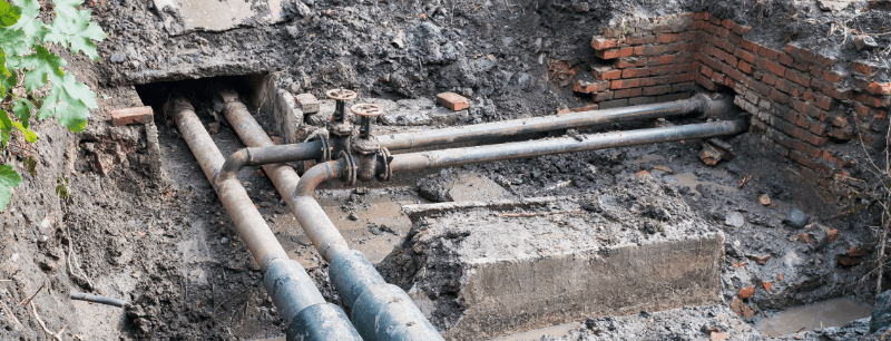
“Topography” is the study of the landscape. Topographical surveys are highly accurate laser-measured surveys that gather data about the features of the landscape. This kind of survey will locate and map natural features like trees, lakes, ditches, hills and rivers. It will also gather data about man-made features like walkways, buildings, service cover positions and site boundaries. 

Do I need a topographical survey?

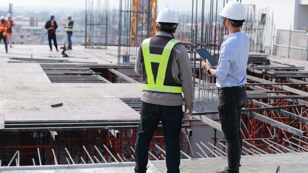
If you’re planning any kind of construction, you may need a topographical survey. If you’re just building a shed in your back garden, you probably won’t need a topographical survey. The larger and more complicated your construction is, the more and more likely you are to need a topo survey. 

Every development will come with its own design and planning challenges. A topographic survey can help you make sure you run into any hidden land features sooner rather than later. It will help you form the basis for any future construction work. For instance, if your plans span over a large expanse of land and include multiple different structures, you’re quite likely to run into at least something in the topographical survey that needs dealing with. Without a topographical survey, you could run into issues during the building process (at which point things would be more costly to rectify) like sloping ground or ditches that you weren’t aware of before. 

What happens if I don’t get a topographical survey?

Ultimately, you don’t know what you don’t know. It’s simply a question of risk. 

On the one hand, you could pay to get a topographical survey and it could reveal no issues, and you can then continue with your development. Alternatively, the topo survey could reveal problems that you can fix before building starts. 

On the other hand, you could skip the topo survey. This could have two outcomes: either the development goes off without a hitch and you’ve saved some cash, or you run into issues during development that you could have identified during the topographical survey. 

It can help to view a topographical survey as an investment. It will act as an opportunity for expert land surveyors to tell you everything you need to know about the land you’re developing. This can help you make the right decisions for your development. We’ll explain the benefits of a topographical survey more below.

Benefits of a topographical survey

  • You get a complete picture of the land you’re developing. This includes off-site and near-site features that could slow or stop development. 
  • It will give you visibility over the whole plot of land, which will in turn help you figure out which design and construction methods will work best. 
  • The risk of costly mistakes caused by unforeseen issues will be reduced.
  • You’ll potentially save time and money by being able to provide your design and build team with information about land constraints. 
  • It could make you aware of any need for additional surveys well in advance.

What happens if you don’t get a topographical survey?

If you’re trying to pinch pennies when it comes to your development, you might be tempted to skip a topographical survey. But skipping the survey can cost you much more down the line. 

Not getting a topographical survey could have no negative impact on you at all, and your development could go off without a hitch. However, it’s more likely you’ll run into issues. These problems could range from frustrating to outright dangerous and costly. 

At the less serious end of the spectrum, you could be looking at things like boundary issues resulting in planning permission being denied. This can be annoying and take time, but it only slows you down rather than stopping development entirely. You can make any necessary changes to your planning and resubmit your application. 

However, there could be much more serious repercussions. For instance, you could build too close to a retaining wall. This could then result in the total collapse of the structure, which is dangerous and pricey. With a topographical survey, this can be avoided. 

A lot of issues that come up in a topographical survey wouldn’t be immediately apparent, even with a stroll around the land. Unless it’s something very obvious, like a large hill or river, the land can appear completely normal. This means that if you skip the topographical survey, even if the initial development goes off without a hitch, you could be facing pricey mistakes even years after you’re finished building. 

What’s the process of a topographical survey? 

Topographical surveys are pretty straightforward. They’re very similar to other land and building surveys (like measured building surveys). Here’s how it works: 

Step 1:

Discuss your objectives and the site with your chosen surveyor. The surveyor will then be able to adapt their process to fit your circumstances and make recommendations about the level of detail your survey may need. They will also be able to give you a rough time and price estimate at this point. Here at Midland Survey we can accommodate plans provided to us as a starting point, and tailor our process from here to fit your individual needs.  

Step 2:

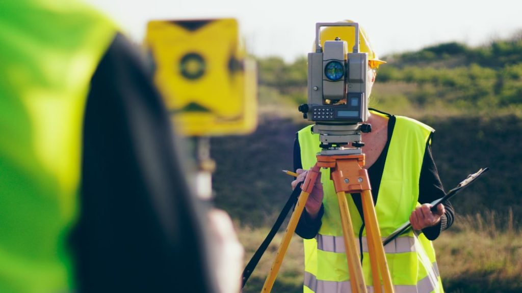
Experts from your chosen surveyor will visit your site and carry out the survey. The difficulty of this step will depend on the nature of the site. Some sites may be impossible to survey on foot, so the surveyor will need to use highly specialised equipment, like laser drones. At Midlands Survey, we pride ourselves on pushing the industry forward. This means that we will complete this step of the survey using industry best practice, whilst harnessing the power of modern technology to ensure that the survey is efficient, accurate, and cost effective. 

Step 3:

After the survey on site is completed, the surveyors will leave and make CAD drawings of your site. These will be accurate and detailed and give you a complete overview of the property. This will generally take the same amount of time as the time needed onsite. 

Specialist Equipment used for topographical surveys

We strive to use the most accurate and latest technology which leaves no margin for doubt or error. The equipment we will be using is Total Stations as well as detailed terrain mapping as touched upon above.

Using multiple techniques to collect your data means we’re able to present clear and precise drawings of the site. We appreciate your project will always have obstacles to overcome however, an accurate and clear set of site drawings won’t be one of them. 

Having your data results online is convenient. Having said that, we know not everyone works in this way. Sometimes you need to just have the physical copy of the drawings in front of you to work off of. We’re happy to provide you with printout copies of your site so you can work the way you want to. 

Your senior surveyor will provide you with the drawings on CAD software as well as present them in PDFs. 

With you being at the centre of the process, your senior surveyor will work with you to understand your objectives. They’ll actively look to produce results that help you answer those specific questions. 

Types of topographic surveys

These are the different types of topographic surveys which are used for a variety of 

2D and 3D topographic surveys

Typically we have seen 2D surveys being used on construction projects but we also know 3D surveys give a wealth of information about the built environment and infrastructure of the project. 

Boundary Surveys 

The last thing you need is a battle with a partition lawyer. Understand the boundaries of your site to the most precise measurements with a boundary survey for a smooth project from a boundary standpoint. 

Setting out

Your architect is going to want to get their hands on the setting out survey. Being able to understand the scalability and relationship to other obstacles, buildings and structures allow for accuracy from the architect early on.

Contour Surveys 

This type of survey will take a look at the contours of your site which can heavily affect the design and accessibility of your site. 

GPS (VRS) Surveys 

By using satellite imagery, this survey collects data which allows us to measure the distance and dimensions of space between structures with accuracy.

Monitoring Surveys 

When movement goes undetected, the completion of the build is in jeopardy. Spotting movement early on and being able to create solutions to prevent it is unveiled by a monitoring survey

Cross-Section Surveys 

The cross-section survey allows you to understand the difference between site design and the actual terrain.

Ecological Surveys 

Making sure you don’t disturb the ecological setting of your site is a crucial part of your planning permissions and conditions. This survey will give you an understanding of the nature of your site and how you can benefit the quality of the site’s ecology

If you’d like to discuss topographical surveys for your property, contact us here at Midland Survey to see how we can help you. We are one of the UK’s most trusted surveyors, and we can help you avoid unforeseen issues with your development. Book a topographical survey with us today.

Renovating? Remodelling? Restoring? Then you’ve probably heard the words “measured building survey”. If you’re planning on doing any major work on your property, planning in a measured building survey is a vital part of that. Measured building surveys give you an accurate view of a building and all its structural and architectural elements. You’ll be able to get a floor plan, roof plan, elevations, sections, reflective ceiling plans… If you’ve wanted to see a plan of any part of your property, a measured building survey can help you get there. But all this doesn’t come free of course, which brings us to the question: how much does a measured building survey cost? 

But first… what are measured building surveys anyway? 

Let’s take a step back. There’s so much jargon around building surveying that it can be easy to get lost and have difficulty figuring out what you need. 

A measured building survey differs from the sort of survey you need when buying a house. A measured building survey is needed for property redevelopment or extensions. They can also be useful for homeowners who wish to build a detailed safety plan. They involve taking measurements of the building in order to produce very accurate data represented at a reduced scale. This data is shown as a floor plan, with extra levels of data like elevations and cross sections as needed. They are presented as scaled survey drawings. 

Measured building survey being carried out on a site with a crane in the background.

When commissioning a measured survey, you’ll agree on a specification for the level of detail and accuracy, as well as delivery time. 

So… how much does a measured building survey cost? 

We know you’ve clicked on this blog post hoping for a clear cut answer, but the truth is that every measured building survey will cost something different. Fees will depend on a few things: 

What you need a measured building survey for

Do you just want floor plans? Roof plans? Sections? Elevations? A combination? The whole package? Depending on what you need from your survey, the cost will vary. Here at Midland Survey, we can produce the surveys listed above in isolation or as an integrated package. We will work with you to adapt your plans and advise you on what you’ll need, in a way that fits with your objective and your budget. 

Why you need a measured building survey

If you’re renovating, you may need a different set of information than if you’re adding on a major extension. 

The property itself

A small, simple property with easy access will cost less to survey than a sprawling property which is tricky to access. For instance, a measured survey floor plan of a simple flat, with reasonable access, may require 3 or 4 hours on site and a day’s work generating a CAD drawing (in plan view only) of each floor. This may cost about £1000 (plus VAT) – however, remember that this is just an estimate and may not be applicable to your situation, even if it’s similar. 

The measured building survey itself

If you just need a simple floor or roof plan, this will cost less than a full package survey. 

As soon as extra levels of detail are needed, the time needed to complete the survey will increase, and so will the price. If the building is very ornate and a high level of accuracy and detail is required, for example, then the survey is likely to cost more. 

Women in high vis and hard hat is measuring a wall and holding an ipad.

For instance, if there is very little sufficient safe access, then a laser scanning drone may be needed, which can be pricey. If this data can be taken from survey imagery and a laser theodolite survey, a drone may not be needed, but this method is less accurate. 

What equipment is used for a measured building survey?

So, you know that the equipment needed can bump up the price of your survey (like laser drone usage), which might naturally make you curious about the rest of the equipment. The standard equipment will be the same for every survey though, and won’t drive your cost up. 

Here’s a list of the standard equipment it’s likely for a surveyor to need: 

  • Tape measure and laser measure

A  laser tape measure is the modern, hyper accurate counterpart of the good old traditional tape measure. It can measure up to 20 metres, with an accuracy of 2 millimetres. These are speedy, accurate, and easy to use. 

Your surveyor is still likely to carry a traditional tape measure though, for taking small measurements quickly. 

  • Laser Scanners 

Our range of laser scanning equipment can pick up millions of measured points to give a detailed outline of a building. This technology is efficient and accurate.

  • PPE

You’re most likely to see a surveyor in PPE, including safety shoes, high vis, gloves and a helmet. 

Surveyor using measured building survey equipment with blue skies behind him.

Here at Midland Survey, we recently invested in new survey equipment, so we can undertake the high-tech parts of the surveying with accuracy, efficiency and ease. 

Get a quote for a measured building survey

We know, you came to this blog looking for answers and we’ve only been able to give you rough estimates. Due to the huge range of buildings and the differences from one survey to the next, it’s nearly impossible to answer this question without talking about your specific circumstances. 

The best way to get an accurate estimate of how much a measured building survey costs is to get in touch with a surveyor. They’ll be able to advise you based on your needs and your property. If you’re based in the United Kingdom and you’re after a measured building survey, contact us today. We can advise you and help you make your renovation dreams a reality. 

In February our Drainage Repair department was launched and now runs in tandem with our CCTV drainage survey team. Not only can MSL Surveys identify defects we can now also offer solutions to problems identified in our survey reports.

Much of the drainage repair work is, remarkably, unintrusive. Using bespoke equipment most repairs can be undertaken with the skill of a keyhole surgeon! Not only is this an efficient process, but it is also neat, cost effective and safe.