
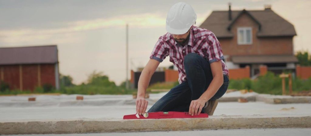
You need to know what’s going on beneath the surface before you embark on a building or construction project. There’s a world right under your feet. Otherwise, the project could interfere with or damage below-ground pipes used to transport water, power, gas or sewage. Arranging an underground utility survey could lower the risks builders, developers, engineers, and utility owners face.
Surveying underground utilities can save both time and money in the long run. Underground utility surveys protect the safety of workers and the public and minimise project delays. In this article, we address how you could benefit from an underground utility survey.
What is an underground utility survey?
An underground utility survey is meant to create a map of precisely which services are underground and where. Developers can familiarise themselves with the whereabouts of subsurface utility infrastructures like piping, cabling, ducts, sewers and drains.
New building or construction work projected for the site can be planned with this information in mind. When developers know the environmental constraints for the project, an array of potential hindrances can be avoided.
How could this kind of underground survey benefit you?
At Midland Survey, our surveyors are trained in creating comprehensive maps of underground utilities located in and nearby clients’ sites. These maps can also be paired with topographical maps indicating the layout of above-ground features on the same site.
Once you have an accurate drawing, you can easily avoid making mistakes that would require a lot of time and money to reverse. For example, you could avert running into legal issues or needing to reschedule any of the work
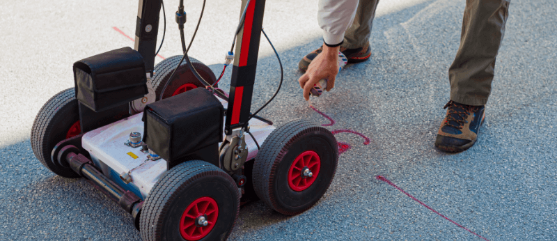
What is ground penetrating radar (GPR)?
This revolutionary technology works by emitting energy pulses into the ground, where they bounce off buried materials and indicate their locations to the GPR user, who will be moving a transducer or antenna along the ground.
When surveying underground utilities, GPR technology is reserved for detecting non-metallic objects, like plastic pipes, concrete or clay. For locating metal pieces, radio frequency location (RFL) technology achieves more accurate results.
What are CAT locators?
No, they aren’t quite devices designed to help people find their cats. The ‘CAT’ here is an acronym standing for Cable Avoidance Tool and used in reference to RFL technology that traces signals emitted by targets located beneath the ground.
As RFL only works on targets that emit signals, it can only be used for determining the locations and dimensions of metal objects. CAT tools can thus assist in collecting information about metallic fuel, vent, water and gas pipes as well as metallic telecommunication and TV cables.
What are Genny (signal generator) tools?
These are meant to be operated in conjunction with CAT locators. By passing signals into the ground, a Genny tool can assist the user in more quickly and precisely tracing a range of utilities. Using a CAT and Genny can prove much more effective than using a CAT alone.
This is why, for the task of surveying underground utilities, we use CATs and Genny tools together as standard. However, we also combine them with use of the earlier-mentioned GPR technology so that, for our clients, we map out underground utilities as efficiently as possible.
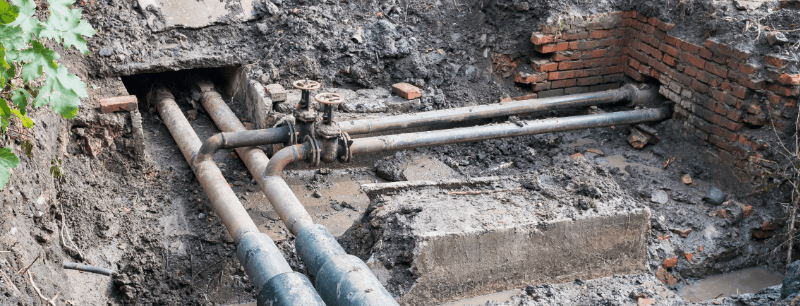
How can you ascertain the condition of drainage pipes?
As we have established, an underground utility survey undertaken by our team can help you to discern what and where drainage pipes are. However, you would need a different service to find out about their condition. Fortunately, we offer this service in the form of CCTV drainage surveying.
This would entail inserting a CCTV camera down piping so that, on a monitor, we can see inside the drainage system without any ground being dug up beforehand. This is important because above-ground building work could adversely affect subterranean pipes already in unsatisfactory condition.
What risks could your construction project pose to underground utilities?
As acknowledged earlier in this article, building work above ground can accidentally cause damage to utilities. Even if this work follows suitable protocols, it could compromise any nearby piping that has deteriorated.
The use of heavy machinery can lead to ground subsidence damaging such pipes. You could therefore counter this risk by having affected piping relined — one kind of drainage repair work Midland Survey can complete in a non-intrusive fashion.
Are you intent on a building or construction project?
It is essential that you organise an underground utility survey in advance. The mere presence of underground utilities can have major implications for the planning and design stages of a project.
From surveying underground utilities on behalf of clients, we accurately record the locations of gas pipes, fibre optic cables, communications cables, and subsurface infrastructure. Clients can easily contact us to book an underground survey. Get in touch today to find out more about how we can help you.
