Are you carrying out subsurface mapping on your upcoming project? If you want highly accurate results, and no costly mistakes, Ground Penetrating Radar (GPR) surveys could be the right solution for your project. 

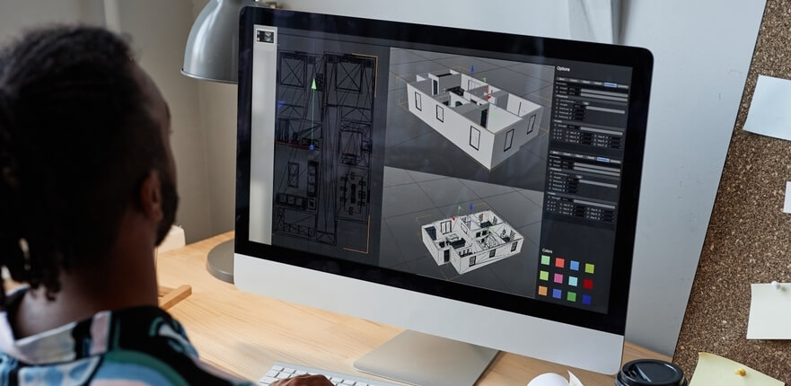
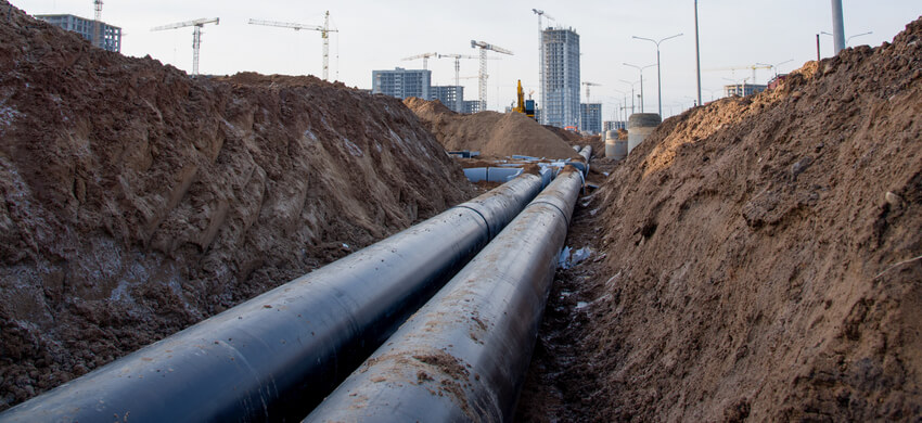
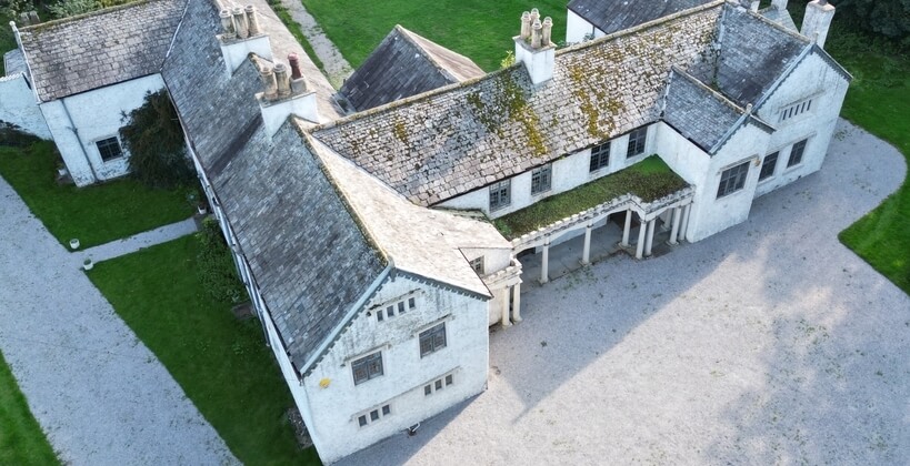
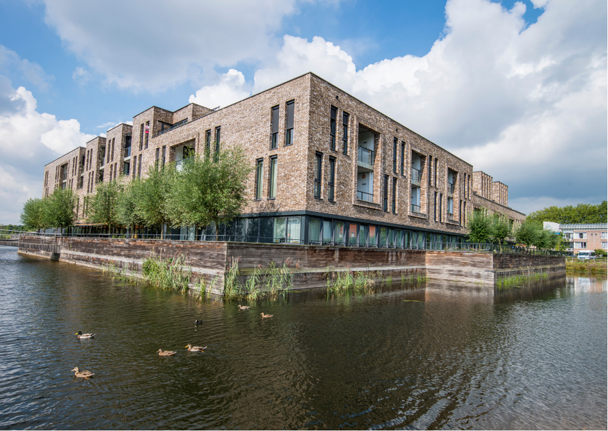
Subsurface mapping is so important in creating a map of the underground of a work site. Whether you are a developer, an architect, or a planner, you can study the underground properties to determine utility infrastructure including piping, cabling, drains and sewers, etc. It is a crucial part of the process to ensure the building site can be prepared with this information in mind.

GPR surveys are particularly helpful in helping to detect non-metallic objects such as plastic pipes, concrete, or clay. Completing subsurface mapping can save time and money in the long run by preventing costly mistakes that could be difficult to reverse. 

So, let’s prevent any costly mistakes and discover the power of GPR surveys in subsurface mapping.

How does GPR technology work?

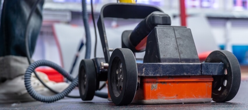
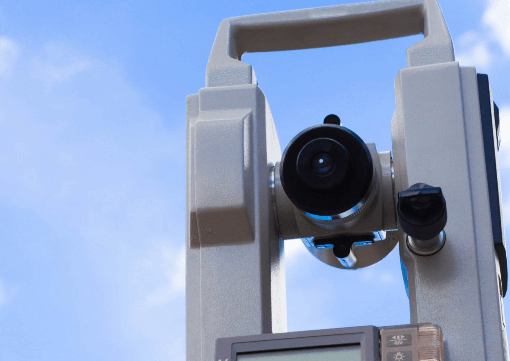
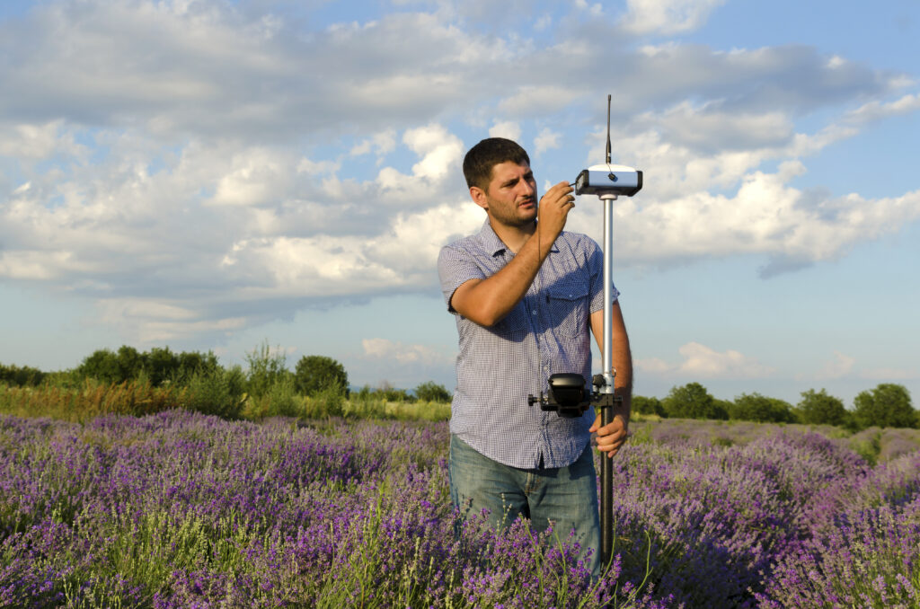
GPR technology sends a high-frequency electromagnetic pulse into the ground using a transmitter. The radar signals are then reflected and detected by the antenna.  

Next, the signals are processed and displayed on a graphic recorder. The transmitter and antenna move across the area of interest, and the graphic recorder will create a final radar image. 

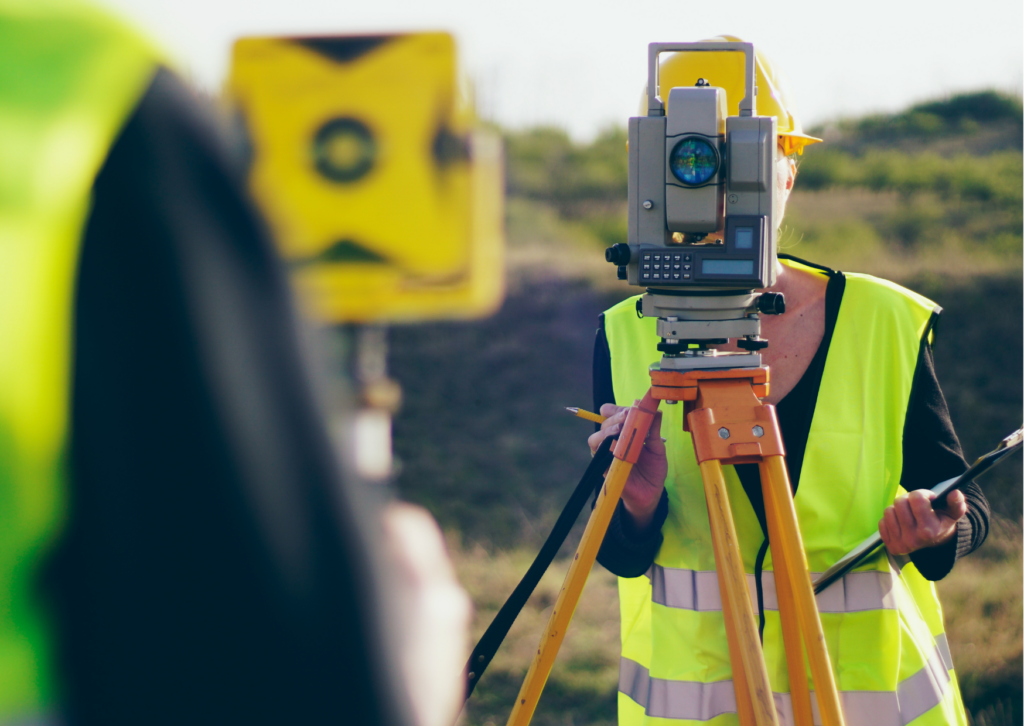
This technique is standard in completing our underground utility surveys to ensure highly accurate results. 

A vital component of GPR technology is resolution. Our surveyors are experienced in using a combination of frequencies to produce accurate results. By using a combination of lower frequency and higher frequency antennas, our surveyors can ensure a high resolution but are also able to identify different features and smaller objects.

What are the benefits of using GPR Surveys in Subsurface Mapping? 

There are many advantages to using GPR surveys in subsurface mapping: 

  • Highly accurate results: through their ability to detect both metallic and non-metallic objects. 
  • Cost-effective solution: allows developers to prevent delays and structural damage through thorough planning. 
  • Fast data collection: the high-resolution image is created in a matter of minutes, making it cheaper and safer than radiography. 
  • Non-destructive and safe: you only need single-sided access, making it an ideal solution for public spaces.

How can GPR surveys help you?

There are various ways that GPR surveys are being used in the construction industry. Here are some common applications:

  • Construction details: to determine the general construction such as material, location, and thickness.
  • Concrete mapping: provides clear radar images on thin concrete floors, roads, pavements, walls, tunnels, and balconies to locate and map rebar tendons and conduits.
  • Floor slabs: to identify voids below the slabs to prevent structural damage.
  • Chimney flue location: detects the location of a chimney flue by detecting the change in the material of the masonry wall and flue void.
  • Locating embedded steel in masonry: due to its non-invasive nature it is effective for use on listed buildings.
  • Hazardous waste: detects any hazardous leaks or contamination.

GPR in practice on a level six service avoidance survey

On a large college field in Oxfordshire, we had to detect air raid shelters for a client with short turnaround times. We suggested the level six service avoidance survey due to the tight deadline. 

This project used the Cobra GPR unit to scan the grid at 1m intervals and detect each anomaly or service found. We also used on-site analysis of the RD10000 GPR unit to cross-reference the data collected by the Cobra GPR unit. 

We found the air raid shelters with both GPR units efficiently and accurately. Using GPR surveys in subsurface mapping improved the efficiency and success of the project. Moreover, we completed the project within the client’s deadline and budget.

Considering GPR Surveys for Subsurface Mapping in Your Next Project?

As we have discussed, GPR surveys can provide numerous capabilities and applications in subsurface mapping. From detecting plastic pipes to identifying voids, it is a highly accurate and efficient method. 

The technology is constantly evolving. Researchers and developers are working on novel antenna designs, signal processing algorithms, and advanced imaging techniques to improve the resolution without compromising the ability to penetrate the ground. AI is revolutionising GPR surveys, enabling faster and more accurate identification of subsurface features.

The demand for highly accurate and efficient subsurface mapping is driving the rapid development of Ground Penetrating Radar surveys. If you have an upcoming project you would like to unleash the power of GPR surveys in subsurface mapping, then get in touch with us and we will provide you with all of the information you need to execute your project with success.

Having been in the surveying industry for over 35 years, here at Midland Survey, we know the importance of surveying the future with ever-evolving technologies. 

It is crucial to be at the forefront of innovation to ensure we continue to provide the most efficient, accurate, and affordable solutions to all of our clients. 

Find out the latest surveying trends for 2024 for surveying the future of this industry. From Building Information Modelling to robotics, the industry has an exciting future ahead.

Significant developments in technology have pushed the surveying industry forward. This improvement in technology is helping land surveyors collect data and improve the accuracy of the data itself. 

Due to various factors such as an increasing population and increasing urbanisation, land surveying is a highly profitable industry. However, there are increasing challenges facing the industry, such as the climate crisis with the built environment estimated to be responsible for around 40% of global carbon emissions. 2024 is likely to see further improvements and more action being taken regarding the ongoing climate crisis.

Surveying the future with a drone across a field of crops.

Advancements in Building Information Modelling Surveying Software for 2024

Building information modelling (BIM) has slowly been integrated into various sectors of the surveying industry. Surveying trends for 2024 will certainly include BIM integration. In fact, from January 2024, public works contracts over £100m will have BIM requirements and over the next four years these requirements will be extended to include projects with a value of less than £1m

The integration of BIM will significantly enhance the efficiency, communication, and cost of land surveying projects. Furthermore, advancements in the Internet of Things (IoT) will improve data integration with its ability to provide real-time data, improve asset management, and manage building operations more efficiently due to its remote monitoring capabilities. 

Blockchain-Enabled Surveying Software Innovations for 2024

Additionally, the advancement of blockchain technology will further improve the ability of BIM through improved security. This reduces the risk of data manipulation and streamlining the supply chain management by recording transactions preventing the risk of defects or delays. This improvement makes it a key surveying software for 2024.

Leveraging LiDAR Technology as a Key Surveying Trend for 2024

Another significant innovation in the surveying industry is LiDAR technology. This technology provides accurate 3D measurements of the earth’s surface allowing for detailed mapping. Further advancements in sensor technology will further improve the efficiency and effectiveness of LiDAR systems. 

As well as integrating it with other technologies such as BIM, it will allow surveyors to create actionable insights using the data from the LiDAR technology. This technology can be initially quite expensive, due to its accuracy and precision. However, it could be worth investing in for surveying the future.

Robotics at the Forefront of Surveying The Future

There has also been a significant impact of the advancement in robotics on the surveying industry. Innovations in drones and sensors have made this technology increasingly accessible helping to improve both productivity and efficiency within the surveying industry. 

For example, within just hours, a drone could fly over a site and take high-resolution photos, reducing the time it takes to use traditional surveying techniques. It is also safer by having the robots enter potentially unknown and hazardous locations. Further advancements in robotics could see the surveying of the future very different from today.

Surveying The Future with Midland Survey

Surveying the future will continue to evolve and change as technology advances and social priorities change. Here at Midland Survey, we realise the significance of staying informed in this dynamic landscape. We want to ensure our customers are always receiving the best possible services at the best possible price. 

Although we may not have yet been driven out of our jobs by robots yet. It is important to utilise this technology and further improve our efficiency and accuracy for surveying the future.

Looking for advice on the most effective survey for your project? Get in touch with our expert team today?

Before starting a project, developers need to know about any ecological issues or limitations and how to minimise the negative impact on the site’s natural environment. Maintaining biodiversity is key to looking after an area where a site, albeit residential or commercial, will be built. And thorough ecological surveys can help to preserve biodiversity. 

At Midland Survey, we offer comprehensive topographical surveys which can include ecological surveys. Here we take a look into different types of ecological surveys to preserve your biodiversity. 

Preliminary Ecological Appraisal

A preliminary ecological appraisal provides an initial site assessment and helps you understand the ecological challenges of the development. This early-stage appraisal will also inform you about the potential ecological impacts of development, therefore, it is a crucial ecological survey to preserve the biodiversity of the local environment.

Ecological Impact Assessment 

Ecological Impact Assessments (not to be confused with Environmental Impact Assessments) are used to identify, assess, and quantify the potential impacts of development on the environment, including habitats, ecosystems, and more. 

An EIA is also known as a Phase 1 Habitat Survey, since it involves mapping out the main habitats on the site, including woodland, hedgerows, trees, ponds, and more. 

Protected species survey

Fun fact, 7 of the most endangered species on earth are found in the UK. At Midland Survey, we provide comprehensive protected species surveys as part of our ecological survey services. 

Examples of protected species surveys include

  • Water vole surveys
  • Owl surveys
  • Bat surveys
  • Badger surveys
  • Bird surveys
  • Newt surveys
  • Reptile surveys

Botanical survey 

In-depth botanical surveys classify habitats and take note of any protected species. In the pre-development phase, a botanical survey helps you understand the possible effects on the trees or the vegetation in the area. Botanical surveys could thereby be key to protecting your biodiversity on a site.

Woman in a hardhat holding an iPad looking at wind turbines.

What if I need multiple ecological surveys? 

You may find yourself needing to do several different types of ecological surveys on a site, that’s certainly no problem with us. Our team at Midland Survey offer a variety of ecological surveys which can be integrated with our 2D and 3D topographical surveys.

How Midland survey can help

Are you looking to get an ecological survey done soon? We are the UK’s most trusted surveying business and we can provide ecological surveys to meet your needs. Our experienced surveyors have successfully carried out work on a diverse range of sites, and no job is too difficult. 
Interested in an ecological survey from us? Get a quick quote today or call us on 01926 810811 or mail@midlandsurvey.co.uk.

Dominoes being stopped from falling over. The word 'risk' is displayed in between the fallen dominoes and the dominoes still standing.

Every building project, whether commercial, residential, or industrial, will come with its share of risks and limitations. It’s all about how you assess and manage these risks effectively and make sure safety is paramount at all times. An underground utility survey aims to identify the location of subsurface utility infrastructure to form a detailed map for the client. 

At Midland Survey, we are the UK’s most trusted surveying provider, and we regularly perform successful underground utility surveys for satisfied clients, including for the most complex of projects. Here we delve into how underground utility surveys help with risk management.

Prioritising the safety of workers and the public

The Health and Safety at Work Act is there to protect builders and contractors working on projects. Underground utility surveys are a measure to help prioritise protecting workers against things like underground cables, electrocution, unsanitary drainage systems, and more. 

In addition to prioritising the safety of workers against safety risks, underground utility surveys also help to protect the general public and residents. For example, a damaged water drain bursting may not only cause property damage, but it could also cause a public health risk to residents. Underground utility surveys are there to mitigate risks and scope out subsurface issues before building projects commence. 

Avoiding accidental contact with electrical cables 

One of the biggest risks posed by building workers undertaking subsurface work is being electrocuted by underground electrical cables, and this can be more easily done than you might think. Another benefit of underground utility surveys is that they scope out the risk of any underground electrical cables beforehand using the latest survey technology devices.

Contributing to important construction project decisions

Before starting a building project, project managers will need to be aware of all the risks involved. Is the land safe to build on? Are there problems with the subsurface infrastructure they need to know about? Thorough underground utility surveys will help to ensure that informed risk management decisions are made. 

It’s better to be safe than sorry and get the underground surveys part right, particularly if people have paid a high price to live on a new residential property development. That’s where we at Midland Survey come in.

Environmental protection

Another service we have recently introduced is providing a Preliminary Geoenvironmental Risk Assessment. A lot of building projects involve a lot of underground digging, and this comes with its share of risks. You don’t want site workers or anybody else (or animals!) getting illnesses due to underground contamination from dangerous chemicals. Combined with our underground utility surveys these can help to protect the environment by checking for subsurface contamination before a building project begins.

A lightbulb next to environmentally friendly signs.

Midland Survey make the most of the latest survey technology for risk management

A key way underground utility surveys help with risk management is by using the latest survey technology and equipment, with highly trained staff.. At Midland Survey, we use non-invasive technology to perform GPR surveys for commonly detected underground objects including pipes, wiring and fibre optics. 
Interested in getting an underground utility survey to improve your risk management for a project? Get in touch with Midland Survey by calling us on 01926 810811 or emailing mail@midlandsurvey.co.uk.

3D modelling in surveying means creating a 3D computer model of a structure or building. The 3D model provides everyone with an accurate visual representation of its size, shape and texture. 

3D modelling can be useful in planning since it can create in-depth 3D designs for buildings and structures that haven’t been built yet. Need to win over key project stakeholders and decision-makers for a proposed development? A 3D model could help to bring your idea to life and give stakeholders an insight into the plans. Building Information Modelling is compulsory for UK public-funded building projects. 

Here we go into a little more detail into the impact of 3D modelling on surveying in the UK. 

3D modelling saves time and money

3D laser scanning surveys can save significant time and money because they allow architects and building designers to identify issues and defects early on in the process before it gets further down the road and more money is spent. 

At Midland Survey, we cherish modern surveying technology and all its wonders. Time is money in the building game. Fortunately, comprehensive 3D data capture surveys prevent staff in building or renovation projects from needing to do multiple site visits. 

Image of a 3D modelling design.

Surveying historical buildings 

Historical buildings need to undergo thorough surveying prior to any new renovations or building changes taking place. 3D laser scanning technology is often used today to survey historical buildings. Looking after historic buildings is important, and you want to do your homework with 3D surveys to reduce the risk of there being any costly damage down the line due to a lack of due diligence in the planning stage.

3D modelling is a non-invasive surveying method for historic buildings. 

At Midland Survey, using 3D modelling to survey historical buildings is one of our expertise. Find out more in this case study of our handheld 3D scanning project for Oriel College, University of Oxford. 

How accurate is 3D survey modelling?

3D scanning is a highly accurate surveying technique, and it can provide you with a representative geometry of a historic building. No need to assume that every wall is a straight line. Got a bend? No problem!

Minimising data loss

On-site data is being collected far more diligently and accurately thanks to 3D modelling. Previously, before advances in technology, measurements and key pieces of data could be missed or lost in translation, but this is no longer the case with 3D laser scanning. 

After an intricate 3D modelling survey? Get in contact with Midland Survey today by calling 01926 810 811 or emailing mail@mslsurveys.co.uk

In the UK, we take pride in protecting historic buildings, whether they are residential homes, commercial spaces, or belong to a heritage conservation organisation like the National Trust. On the National Heritage List for England alone, there are a total of 400,000 listed buildings. When it comes to making renovations and significant changes to historic buildings, you will need a robust measured building survey before going any further. Lead with precaution, after all, the structures of historic buildings can be fragile. 

At Midland Survey, we are one of the UK’s most trusted surveying companies. We provide highly precise measured building surveys for historic buildings, including FARO scanners for external work and smaller handheld 3D scanners for any internal work. Here we delve a bit more into how measured building surveys can be used on historic buildings. 

Image of a medieval English historic building home.

Detailed measurements of historical structures of historic buildings 

Thick strong beams, pitched roofs, and slanting floors and some of the structures you may encounter when surveying historic buildings. At Midland Survey, we understand the importance of using modern technology in our surveying work and embrace it. We manage to capture detailed data on historical buildings using 3D laser scanning that we then use to create floor plans, elevations, cross-sections, and as-built drawings.

At Midland Survey, we leave no stone unturned when providing detailed measurements for measured surveys of historic buildings.

How do measured building surveys contribute to restoration and conservation projects? 

Health and safety are everything when you are restoring, conserving, or renovating a historic building. Without an in-depth measured building survey being carried out beforehand, a project may not be able to go ahead safely. 

Want to renovate an original Tudor property for instance? Not having a measured building survey would be illogical, and moving one beam could cause the whole structure of the building to cave in. 

Historians find our survey drawings extremely useful, not only because they can be used as a base plan for their own information but they can reveal the evolving development of the building over hundreds of years. For example in a church you may see the thick stone walls from the early building, then as other additions were added at a later date, the construction may appear slightly different, perhaps from better structural understanding or with the benefit of using ‘modern’ materials and techniques.

If the historic building is listed, remember you will have to ask permission from your local planning authority to make any changes to the building fabric. Our drawings will illustrate what is present and help with your proposals.

Keeping in line with the original design

One of the primary goals of surveys for historic buildings is to ensure restoration or renovation changes will align well with the original design. Proving that any proposed changes will fit in nicely with the original layout through measured surveys could be the deciding factor in whether you get planning permission or not for a historic building.

On top of measured surveys, we can also provide the following surveying services for historic buildings

Do you have a historic building that is in need of a measured building survey? If so, get in contact with Midland Survey by calling us on 01926 810811 or sending an email to mail@midlandsurvey.co.uk. We have local offices in Southam, Stroud, Leeds, Horsham and Milton Keynes.

We’re here to tell you more about the importance of surveying in construction. Whilst projects and builds span across commercial and residential properties, surveying is an essential part of the collaborative and efficient building. 

We’ll take a closer look at how an accurate survey can prevent budgeting issues, retrospective work, and problems with health and safety. 

Knowing which survey is best for your project is the first step. You might need a GPS survey or 3D scanners or a Ground Penetrating Radar survey. While some of these surveys might be services you’ve used in the past, allowing Midland Survey to guide you through the most cost-effective survey is a great place to start. 

What are the benefits of surveying?

The importance of surveying in construction lies in its benefits. We’ve listed some key benefits that have helped clients in the past and could certainly help you in the future.

Image of two construction works assessing a building.

Covering a broad range of sectors 

More likely than not, our surveys have been used in your sector. Being able to have familiarity with the sector your project is in, allows us to understand what you’re looking for in your results. 

We cover a range of sectors such as aviation, commercial, residential, public and transport and logistics. 

Our experience in aviation alone has offered our clients essential information through our 3D modelling survey

From CCTV drainage surveys on existing builds, or topographical surveys for the pre-plan and design team, we understand that transparency is key for your project to start and finish.

Offering the final product in several formats 

Your construction project might be an ambitious one. Having the results of your survey produced in various formats allows you to have cross-department visibility in your building information modelling. 

Having easy-to-access and easy-to-comprehend displays and results allows the whole team to target foreseen issues which could end up being costly. 

Furthermore, your Midland Survey surveyor will be able to walk you through the findings of any survey allowing you to make accurate decisions with confidence. 

Accurate and cost-efficient service 

Due to having a variety of surveyors and survey types available to you, we’re able to provide you with accurate results. 

As stated above, the accuracy of these results allows you and the team to make crucial changes to the planning and the build before any project-stalling issues arise. 

The ability to have visibility over your project in such detail reduces the chance of having to lean on your contingency budget or delay the completion date which can cost thousands and sometimes millions of pounds. 

The accuracy and detail provided in our surveys are an investment worth making. 

Harnessing the power of technology 

We don’t just use one technology for our surveys, we use the latest and most advanced industry-recognised technology. 

In hand with the technology we use, our surveyors are highly skilled, passionate and experienced in their field. We strive to give you the accuracy you need within a limited time frame. 

Our Measured Building Surveys are driven by the industry knowledge and high standards that our surveyors adhere to. 

From the latest FARO scanner for external surveying and 3D modelling for internal, we know how to marry technology to get you the clearest results. 

Explore our services today and see how Midlands Survey could get your project in clear view. We have experience with a wide range of budgets and project objectives, so make sure you get in touch with us. We’re happy to walk you through the surveying options that will give you the most transparent results. Get a quick quote today.

Building surveys are a vital component of any construction project, whether it’s a commercial build or a renovation. They provide essential information about the condition of the property, identifying any issues that need addressing before construction work can begin. 

However, it can be challenging to know what data to ask for during a building survey. In this article, we will discuss the critical information that you should request from your surveyor to ensure your construction project runs smoothly.

What is a building survey?

A building survey is a comprehensive report on the condition of a property. It aims to identify any defects, damage or potential issues that could affect the building’s structural integrity, safety or value. Building surveys can be tailored to meet specific requirements, but they typically cover the following areas:

  • The property’s overall condition, including any significant defects or areas of concern.
  • The condition of the roof and its supporting structure.
  • The condition of the walls, floors and ceilings.
  • The condition of the plumbing, heating and electrical systems.
  • The presence of any damp or other forms of moisture damage.
  • The condition of any extensions or outbuildings.
Image of a surveyor surveying a building site.

What data should you ask for in a building survey?

Here’s our top list of data you should ask us at Midlands Survey for in your building survey.

Structural condition

The structural condition of a building is one of the most crucial pieces of information to gather during a building survey. You should ask for details about the construction type, age of the building, and any alterations or repairs that have been made to the structure.

This information will help you to understand the overall condition of the building and identify any potential issues that could impact the project’s feasibility.

Site survey

A site survey provides essential information about the land surrounding the property, including the topography, drainage, and any potential hazards or risks. You should ask for a site survey to help you understand the impact that the site’s features may have on the construction project.

As-built surveys

As-built surveys provide accurate and up-to-date information about the property’s dimensions, layout and features. You should ask for an as-built survey to ensure that the construction project plans accurately reflect the existing building and its surroundings.

Building services surveys

Building services surveys provide detailed information about the property’s heating, ventilation, air conditioning and electrical systems. This information is vital to ensure that these systems are compatible with the planned construction work and that they are in good working order.

Environmental surveys

Environmental surveys provide information about the potential presence of contaminants, such as asbestos or lead, and any other environmental hazards or risks. 

You should ask for an environmental survey to identify any potential hazards that could impact the safety of the construction workers or the building’s future occupants.

How building surveys are used in the construction industry

BIM, which stands for Building Information Modeling, is a digital approach to construction that enables architects, engineers, and contractors to create a virtual model of a building. The model contains detailed information about every aspect of the building, including its structure, systems, and materials.

In BIM, data is stored as objects within the digital model, much like the objects in a video game. Each object represents a real-world component of the building, such as walls, floors, doors, and windows. These objects are connected to each other in a way that reflects the physical relationships between them in the real world.

The data associated with each object includes not only its geometric properties (such as size, shape, and position), but also its functional and performance characteristics (such as its thermal properties, acoustic properties, and fire rating). This data is organized in a way that allows it to be easily accessed and analyzed by various stakeholders throughout the construction process.

BIM data is often represented graphically, in the form of 3D models, renderings, and animations. These visualizations enable stakeholders to better understand the building and its components and to identify potential issues before construction begins.

BIM data provides a comprehensive and integrated view of the building, allowing stakeholders to make informed decisions and collaborate more effectively throughout the construction process.

Get in touch with us at Midland Survey 

The data you’ll want to collect and review can be displayed to you and your stakeholder in various ways. Either electronically or PDF is an option with Midland Survey

Your highly skilled surveyor will walk you through the findings of whatever survey you have conducted at your site which will help you move forward with the build confidently. 
Speak to our friendly team today to discuss your surveying needs and questions. Contact us and we’ll get back to you as soon as possible.

Every local area will have utilities located underground beneath the surface, such as water, oil, and gas pipelines, electrical supply lines, telecommunication and data cabling, and more. Safety must be treated as a number one priority in all building projects. Underground utility surveys ensure that existing underground utilities are located, identified, and mapped out before any work commences.  

Underground utility surveys play a key role in ensuring site safety. After all, people’s lives can be put at risk if hazards are not flagged up appropriately beforehand. In addition, errors stemming from a failure to carry out underground utility surveys can affect local residents, and they won’t be best pleased with suddenly having their water or electricity cut off, for example. 


At Midland Survey, underground utility surveys are one of the specialist survey services we provide. We use cutting-edge technology such as electromagnetic locators and ground penetrating radar (GPR) to allow us to conduct underground surveys with pinpoint accuracy. 

Let’s go further into how they contribute to site safety.

Image of underground utilities.

Underground utility surveys protect site workers and local residents from the risk of injuries and fatalities 

Site accidents can easily lead to serious injuries or fatalities. Therefore, one of the principal purposes of performing underground utility surveys is to protect site workers and local residents from the risk of injuries and fatalities. Gas explosions and electrical shocks are examples of two underground risks that come with harmful consequences.  

Under the Health and Safety at Work Act (HSWA) 1974 and the Management of Health and Safety at Work Regulations 1999, construction firms have a duty to ensure the health, safety and welfare of their employees at work. Carrying out an underground utility survey is part and parcel of ensuring everyone’s safety on site. 

Avoiding accidental damage to underground utilities 

Underground utility surveys help to equip everyone working at the site with detailed accurate information regarding where important pipelines, water supplies, sewage, and electrical wiring are located. So, another significant contribution of underground utility surveys to site safety is preventing accidental water main breaks, power outages, and more during the excavation process. 

At Midland Survey, we use the latest technology to deliver GPR Surveys (Ground Penetrating Radar Surveys) for customers. The wonder of GPR technology is that it is a non-invasive method, therefore it doesn’t require any digging or excavation on the site. 

How much do GPR surveys cost?

You may be wondering about the cost of ground penetrating radar surveys. In summary, a GPR survey carried out by industry experts on a simple site could cost approximately £500 – £700 per day, but a larger more complex site could cost up to £10,000. 

Image of GPR survey machine.

Cutting down on delays and Costs

Alongside enhancing site safety, they can help to reduce the potential for delays and costs on a project. 

Time is money in the construction industry, and you don’t want projects being delayed when the situation could have been easily avoided. 

Fixing damaged utilities can gobble into your time and prove expensive. Construction companies can also incur harsh fines and penalties from governing agencies for any utility damage. 

Having access to detailed data from in-depth underground utility surveys will help to prevent the risk of a project being marred by delays and increased costs. At Midland Survey, we offer competitive rates for bespoke underground utility surveys. Get a quote from us today to find out more. 

Improving project design and Planning

Underground utility surveys can lead to improved project design and planning by helping architects and engineers to create better quality more accurate designs. This in turn can make things more efficient by decreasing the need for a long string of design modifications and alterations down the line. 

Are you interested in getting an underground utility survey? If so, reach out to our friendly knowledgeable team today by calling our head office on 01926 810 811 or sending an email to mail@mslsurveys.co.uk

Have you got major plans to extend or redevelop a property or building? In order to do it safely, you will need to have a measured building survey carried out. Measured building surveys provide you with intricate digitalised recreations of the building’s cross-sections, internal and external elevations, internal floor plans, ceiling plans, and roofs. 

Modern building survey equipment and tools for measured building surveys have replaced traditional equipment such as measuring tapes and pencils. 

At Midland Survey, we passionately believe in doing everything we can to uphold standards and best practice while embracing the power of technology. We are the UK’s leading surveying business and we provide surveying services across a broad range of sectors

But just how accurate are measured building surveys today? Here we have taken a deeper look at the matter. 

Can you get accurate measured surveys for older buildings?

We provide surveys for all types of land and buildings, whether they be for residential buildings, country fields, commercial buildings, cathedrals, or schools. In short, we provide surveys for all types of buildings, old and new. 

Looking to redevelop, repurpose, renovate, or restore an old building and give it a modern transformation? Historic and listed buildings often have intricate structural layouts which differ greatly from modern buildings, this may include timber beams, thatched roofs, and old barns. The good news is that we can use modern technology to help provide accurate surveys for historic buildings.  

Image of a listed building property.

How technology increases the accuracy of measured surveys for older buildings

Using FARO scanners for external work and handheld 3D scanners for internal work, Midland Survey are able to provide highly accurate measured surveys for existing older buildings. This includes highly detailed measured surveys of floor plans, sections and elevations. After all, you need to know what you’re working with, and measured surveys help you out with that.

Take a look at the work Midland Survey conducted to use surveys to assess and resolve the structural issues at St. Albans Abbey. The goal of this work was to help improve safety conditions in an ancient building without affecting its historic integrity.

Architects and construction professionals require high-quality measured building surveys 

Who needs to view in-depth detailed accurate measured building surveys? The answer is that architects and other construction professionals, such as project managers, engineers, and surveyors, all need to view measured building surveys before they start to embark on their work. The slightest inaccuracy could have a significant impact on the building project.

How long does a measured building survey take?

The size of the building will have an impact on how long it takes to perform a measured building survey, but fortunately, we use the latest technology at Midland Survey and this helps to ensure faster turnarounds. Our senior staff will be able to give you a clear and accurate idea of how long we envisage the measured building survey should take. 

Being thorough and meticulous is everything when it comes to getting building surveys right. Of course, you need to factor in that other types of surveys may need to be carried out alongside the measured building survey. We also offer:

Image a man carrying out a topographical survey.

How much do measured building surveys cost?

Now, let’s get onto the topic of how much measured building surveys cost. A brief description of what survey services you need together with a site plan or an aerial view may be enough for us to be able to give you a price. 

However, since our surveys are bespoke to your needs, pricing can vary and it depends on the specifics of the project.

Generally speaking, measured surveys for smaller properties with easy access are cheaper and quicker to produce.  A measured survey floor plan of a simple flat that creates a CAD drawing of each floor may cost you around £1000 in total (plus VAT). More substantial projects usually cost more. You can request a quote here and we will get back to you. 

Get in touch with our team at Midland Survey today if you are looking to get a measured building survey in the United Kingdom. We will provide you with our professional insight into the best solutions for your surveying needs.

If you’ve ever wondered about how we keep our structures safe from natural or man-made changes, you’ve likely stumbled upon the concept of a ‘deformation survey.’ But what exactly is a deformation survey, and what purpose does it serve? Let’s take a closer look.

Building near water Midland Survey

What Is a Deformation Survey?

Simply put, a deformation survey is a specific type of survey designed to measure and record changes in an object’s shape or dimensions. Whether it’s a building, a dam, or a piece of land, a deformation survey can monitor and record any changes over time. These changes could be due to various factors such as weathering, geological activities, or human interventions.

The Critical Role of Deformation Surveys

So why are deformation surveys so crucial? The answer lies in their capacity to provide early warnings for potential problems. Deformation surveys can detect shifts in structures that could lead to significant issues if not addressed promptly. This could be a building starting to lean dangerously, a dam developing small but consequential cracks, or a tunnel beginning to warp.

By identifying these issues early, action can be taken to correct them and prevent more significant problems down the line, such as structural failure that could lead to accidents or even loss of life.

deformation survey UK

Where have deformation surveys been used in the UK?

While Midland Survey takes on an array of different-sized projects, we are always looking at how the industry is utilising surveying as an optimal tool during the building phase. 

Let’s talk about how important deformation surveys are in some of the UK’s biggest projects that have caught our eye. 

Crossrail Project

This is a really big deal for the UK’s infrastructure. During the building phase, these surveys played a big part in making sure the tunnels were safe and sturdy. They also helped us spot any problems with the structure or the land around the works, which was super useful.

Hinkley Point C Nuclear Power Station in Somerset. 

This new power station used deformation surveys a lot during construction. They helped keep an eye on any shifting in the land and made sure everything was structurally sound.

High Speed 2 (HS2) project. 

This is a major high-speed rail network that will connect London with cities up north. During the build, deformation surveys were used to check on structures, hills, and cuttings to make sure everything was stable and good to go.

The Shard in London

During its build, deformation surveys were used to watch for any movement in the structure and to see how it affected the buildings around it. It’s all about making sure everything is safe and sound.

How a deformation survey can work for your project

Through the use of advanced technologies such as GPS and total stations, surveyors at Midland Survey can monitor and measure even the smallest changes in a structure’s position. This information can then be used to create detailed maps and models that clearly highlight any deformation that has occurred.

How to plan your project’s deformation survey

Unsurprisingly, it is an essential tool for maintaining the safety and integrity of our built and natural environments. Whether it’s the Midland Survey team monitoring changes or you making adjustments to your project because of the data shown, the use of deformation surveys is critical in keeping us and our structures safe.
Get in touch with us at Midland Survey to explore your options in arranging a deformation survey. Our highly experienced team are ready to help you with any sized project. We specialise in taking on varied and challenging projects that need expert surveying advice. Let’s start today.

While you may have heard of the term ‘topographical survey’ being batted around during a project, you might be looking to do some of your own research. Here’s our ‘Ultimate Guide to Topographical Surveys’ which should help answer any questions you may have. 

Let’s start at the beginning.

What is a topographical survey?

Simply put, it is a detailed survey of an area of land that shows its physical features, such as hills, valleys, rivers, and roads. It is used to create a 2D or 3D map of the land, which can be used for a variety of purposes, such as planning construction projects, designing landscapes, or creating marketing materials.

Unsurprisingly, 2D or 3D maps are essential tools for core team members such as project managers. The maps will be fed into BIM in construction which stands for Building Information Modelling. 

Project managers use the maps critically to plan the project, communicate with the team, track the progress of the project and document the project for directors and stakeholders alike. 

You can see why choosing a highly experienced professional from the get-go can save thousands of pounds as well as time.

surveyor using equipment

What is included in a topographical survey?

Typically, there are four stages of the topographical survey. However, within these stages are varying degrees of complex data acquisition and evaluation from the surveyor and client. A topographical survey typically includes the following:

  • Surveying Equipment: A variety of surveying equipment is used to collect data for a topographical survey, such as a total station, a theodolite, and a level. (but we’ll talk more about this further down).
  • Data collection: The surveyor will use the surveying equipment to collect data on the physical features of the land, such as its elevation, slope, and vegetation.
  • Data processing: The surveyor will use software to process the data collected from the field and create a 2D or 3D map of the land.
  • Report: The surveyor will create a report that summarises the findings of the survey and includes the 2D or 3D map which feeds into BIM.

What does a topographical survey show?

No two surveys are the same. The type of information that is included in a topographical survey will vary depending on the purpose of the survey. However, all topographical surveys will typically include the following information:

  • The location of the survey area
  • The elevation of the land
  • The slope of the land
  • The location of natural features, such as rivers, lakes, and trees
  • The location of man-made features, such as buildings, roads, and bridges

You can see how this information would certainly help inform progress and adjustments to planning cross-departmentally. 

close up shot of surveying equipment

What are the benefits of a topographical survey?

While you’d think it’s only the construction sector who take advantage of this detailed survey, there are other uses for its purpose too. 

Obviously, topographic surveys can be used to plan construction projects. But you might be surprised to know that design and marketing are often the other two main users of a topographic survey. Let’s take a look at why: 

Designing landscapes: Can be used to design landscapes by providing information on the physical features of the land, such as its elevation, slope, and vegetation. This information can help to create a landscape that is both aesthetically pleasing and functional.

Creating marketing materials: A topographical survey can be used to create marketing materials, such as brochures and websites, by providing information on the physical features of the land. This information can help to attract potential customers and investors.

Which sectors use topographical surveys?

Topographical surveys are used by a variety of sectors, including:

  • Construction: Construction companies use topographical surveys to plan and design construction projects.
  • Engineering: Engineers use topographical surveys to design roads, bridges, and other infrastructure.
  • Architects: Architects use topographical surveys to design buildings and landscapes.
  • Landscape Designers use topographical surveys to design garden layouts.
  • Real estate: Real estate agents use topographical surveys to assess the value of properties.
  • Government agencies: Government agencies use topographical surveys to plan land use and development.

How much does a topographical survey cost?

Unsurprisingly, this is a complex question due to varying factors. The cost of a topographical survey varies depending on the size of the area being surveyed, the complexity of the survey, and the experience of the surveyor. In general, a topographical survey can cost anywhere from £1,000 to £10,000.

How long does a topographical survey take?

The time it takes to complete a topographical survey depends on the size of the area being surveyed, the complexity of the survey, and the availability of the surveyor. In general, a topographical survey can take anywhere from a day to a few weeks.

What is used to measure a topographical survey?

There are a variety of surveying equipment that can be used for a topographical survey. Some of the most common types of equipment include:

  • Total stations: A total station is a surveying instrument that combines the functions of a theodolite and an electronic distance meter. It can be used to measure angles and distances and to create 3D models of the land.
  • Levels: A level is a surveying instrument that is used to measure the elevation of the land. It can be used to create 2D maps of the land, and to ensure that the land is level.
  • GPS receivers: GPS receivers can be used to collect data on the location of points on the land and instantly relate the position to the National Grid coordinate system. This data can be used to create 2D or 3D maps of the land.
  • Laser scanners: Laser scanners can be used to create 3D models of the land. This data can be used for a variety of purposes, such as creating virtual reality models of the land or for collision avoidance systems.

The type of equipment that is used for a topographical survey will vary depending on the size and complexity of the area being surveyed, as well as the experience of the surveyor.

What would affect the production of the topographical survey?

A variety of factors can affect the production of a topographical survey, including:

  • The accuracy of the surveying equipment: The accuracy of the surveying equipment used to create the survey will affect the accuracy of the survey.
  • The skill of the surveyor: The skill of the surveyor will affect the accuracy of the survey.
  • The weather conditions: The weather conditions can affect the accuracy of the survey. For example, if it is raining or snowing, the surveyor may not be able to locate all the necessary features of the site.
  • The topography of the land: The topography of the land can affect the accuracy of the survey. For example, if the land is very hilly, the surveyor may not be able to get an accurate reading of the land.

It is important to be aware of these factors when interpreting a topographical survey. If you are unsure about the accuracy of a survey, it is best to consult with a qualified surveyor. If you’d like to explore our range of services at Midland Survey, get in contact today. Our highly experienced team are happy to guide you through our processes and service to accommodate the right survey for your project.

You may know how surveys are used in a domestic setting but how are measured building surveys used on major construction projects? 

Between commercial and residential builds, measured building surveys are an essential part of any project. 

Construction companies on a national scale lean on the expertise of skilled survey professionals. Building surveys are used to eradicate unforeseen problems with the internal and external structure of any build. 

From the very infancy of most projects, the measured building survey will arm the project managers with fine detail feeding into the project’s BIM. 

construction workers looking over plans

What is the purpose of a measured building survey?

They are usually specified to an agreed level of detail, to acceptable accuracy tolerances, scale, delivery times and costs. Here are some other examples of what is the purpose of a measured building survey: 

  • Plan and cost projects: When planning a construction project, it is important to have a clear understanding of the building’s existing condition. A measured building survey can provide this information, which can help to ensure that the project is planned and costed accurately.
  • Identify potential problems: A measured building survey can identify potential problems with a building, such as structural defects, water damage, or electrical hazards. This information can be used to make repairs or improvements before they become serious problems.
  • Assessing historical work: If the project involves a listed building or site, a measured building survey will be able to assess any movement or considerations of the materials already used. This information may feed into wider applications that involve local councils. 

Why not explore our recent case study on St Albans Abbey belfry to see how our survey helped measure the existing structure? 

If you’d like to discuss your upcoming project with us at Midland Survey, get in touch today.

  • Avoid costly mistakes: A measured building survey can help to avoid costly mistakes by providing accurate information about the building’s condition. For example, if a construction company is planning to demolish a building, a measured building survey can help to ensure that the demolition is done safely. In addition that any asbestos or other hazardous materials are properly disposed of.
  • Meet legal requirements: In some cases, it may be required by law to have a measured building survey before making changes to a building. For example, if you are planning to make changes to a listed building, it may be a requirement to have a measured building survey to ensure that the extension complies with building regulations and planning restrictions.
close up shot of surveying equipment

Who carries out a measured survey?

Highly skilled surveyors would usually carry out your measured building survey. Taking various readings such as roof plans, floor plans, internal elevations, external elevations, reflective ceiling plans, sections, deformation and more, your surveyor will be able to tailor the survey to target what you’re trying to focus on. 
However, construction companies are keen to keep an eye on the project from the get-go so an integrated package of survey drawings is the most effective way of having a full vision of the build.

You’ve probably seen and heard that sustainability in construction is becoming increasingly important. As the world looks to reduce its carbon footprint and mitigate the effects of climate change, you might be wondering ‘how can a survey make my build more sustainable.’

Construction companies have a major role to play in this effort, and one way they can make their builds more sustainable is by conducting an ecological survey.

construction workers looking over plans

What is an ecological survey?

An ecological survey is an assessment of the environmental impact of a proposed construction project. 

The survey will identify any potential risks to wildlife, habitats, and ecosystems in the area where the build will take place. It will also identify opportunities to enhance biodiversity and promote sustainable practices.

Benefits of an ecological survey

There are many benefits to conducting an ecological survey, including:

  • Identifying risks and opportunities: The survey will help construction companies to identify potential risks and opportunities associated with the build, such as the impact on local habitats and wildlife, and opportunities to incorporate sustainable practices.
  • Compliance: An ecological survey is often a requirement for obtaining planning permission for a construction project. Conducting a survey demonstrates a commitment to compliance with environmental regulations and standards.
  • Reputation: Sustainability is becoming an increasingly important factor in the construction industry. Conducting an ecological survey and incorporating sustainable practices into a build can enhance a construction company’s reputation and demonstrate a commitment to environmental stewardship.

How to conduct an ecological survey

Unsurprisingly, conducting an ecological survey is an important process in understanding the health and status of the environment. If you’re planning on conducting an ecological survey, there are several steps you should follow to ensure that the survey is accurate and informative.

First, you need to determine the scope of your survey. This includes identifying the area that you want to survey and the species that you want to study. Once you have determined the scope of your survey, you need to select the appropriate survey techniques. These techniques will depend on the species that you are studying and the environment in which you are conducting the survey.

How can a survey make a build more sustainable? 

When conducting the survey, it is important to record all of your observations and data accurately. This can be done using a variety of tools, such as field notebooks, cameras, and GPS devices. After you have collected your data, you should analyse it to identify any patterns or trends.

Get in touch with Midlands Survey today 

Encouragingly, our surveys at Midland Surveys can identify areas where your building can be improved to reduce its impact on the environment. By implementing the recommended changes, you can reduce energy consumption, lower emissions, and save money on bills.

Get in touch with our highly experienced team today and explore your survey options. We are happy to answer any of your questions.